You are here: Home > Network List > KN - Kyrgyz Seismic Telemetry Network Stations List
> Station TKM2 - > Earthquake Result Viewer
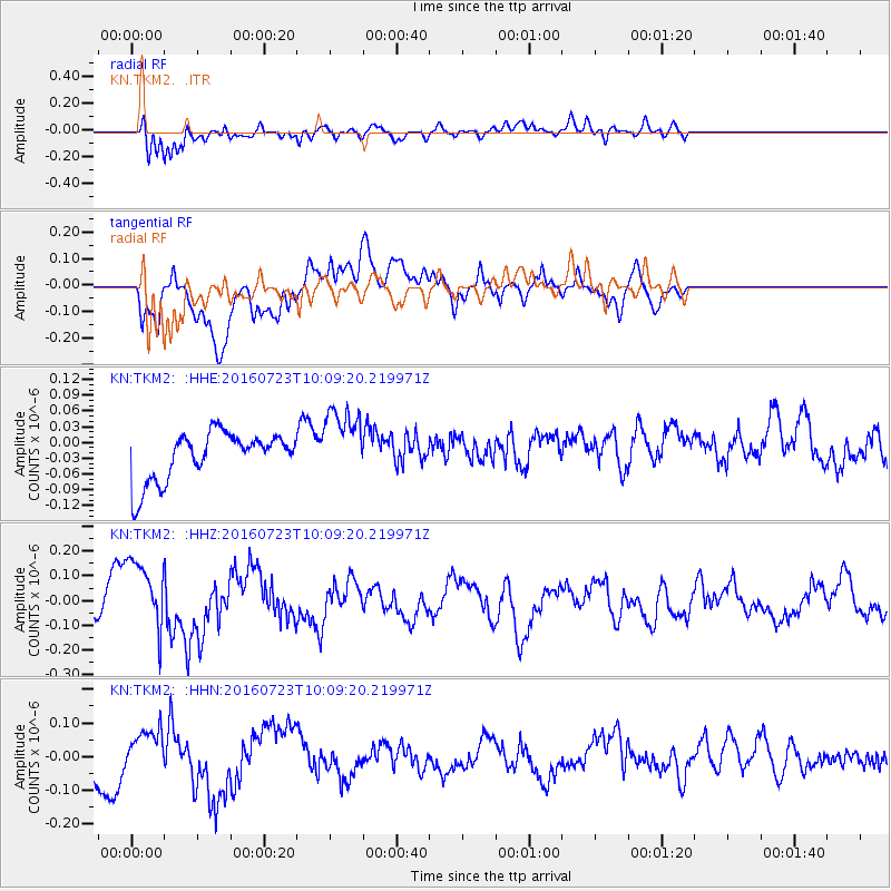
TKM2 - - Earthquake Result Viewer
*The percent match for this event was below the threshold and hence no stack was calculated.
| Earthquake location: |
Alaska Peninsula |
| Earthquake latitude/longitude: |
58.6/-156.6 |
| Earthquake time(UTC): |
2016/07/23 (205) 09:59:00 GMT |
| Earthquake Depth: |
204 km |
| Earthquake Magnitude: |
5.7 MB, 5.1 MI, 5.4 ML |
| Earthquake Catalog/Contributor: |
NEIC PDE/NEIC COMCAT |
|
| Network: |
KN Kyrgyz Seismic Telemetry Network |
| Station: |
TKM2 - |
| Lat/Lon: |
42.92 N/75.60 E |
| Elevation: |
2020 m |
|
| Distance: |
70.0 deg |
| Az: |
321.888 deg |
| Baz: |
26.131 deg |
| Ray Param: |
$rayparam |
*The percent match for this event was below the threshold and hence was not used in the summary stack. |
|
| Radial Match: |
87.04924 % |
| Radial Bump: |
400 |
| Transverse Match: |
53.54043 % |
| Transverse Bump: |
400 |
| SOD ConfigId: |
11737051 |
| Insert Time: |
2019-04-25 03:39:38.750 +0000 |
| GWidth: |
2.5 |
| Max Bumps: |
400 |
| Tol: |
0.001 |
|
Signal To Noise
| Channel | StoN | STA | LTA |
| KN:TKM2: :HHZ:20160723T10:09:20.219971Z | 1.3149397 | 1.5794838E-7 | 1.2011833E-7 |
| KN:TKM2: :HHN:20160723T10:09:20.219971Z | 0.96840435 | 6.994798E-8 | 7.223014E-8 |
| KN:TKM2: :HHE:20160723T10:09:20.219971Z | 1.366284 | 6.49421E-8 | 4.753192E-8 |
| Arrivals |
| Ps | |
| PpPs | |
| PsPs/PpSs | |


