You are here: Home > Network List > US - United States National Seismic Network Stations List
> Station CBKS Cedar Bluff, Kansas, USA > Earthquake Result Viewer
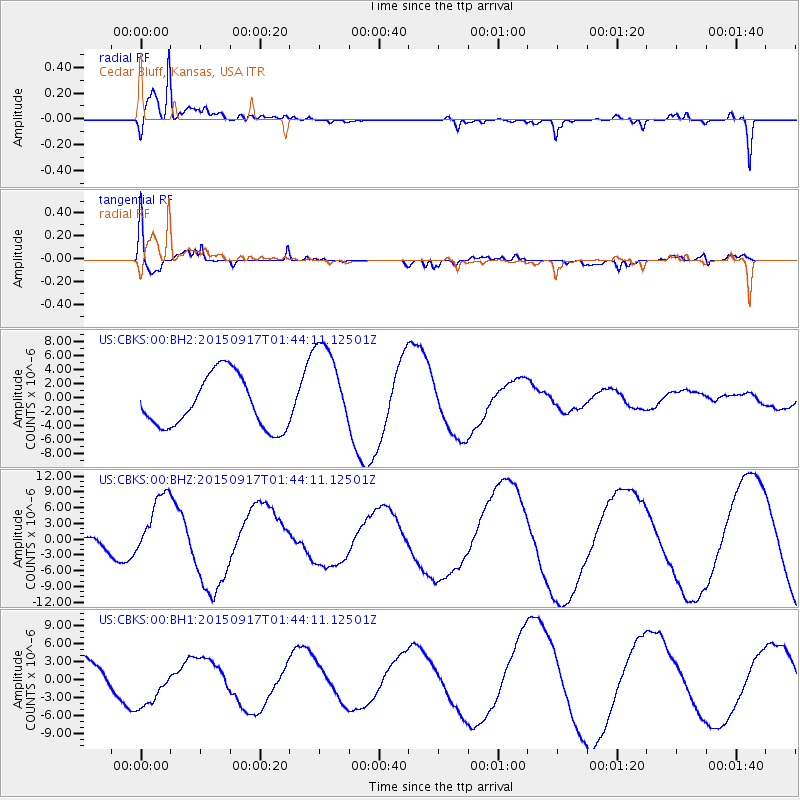
CBKS Cedar Bluff, Kansas, USA - Earthquake Result Viewer
*The percent match for this event was below the threshold and hence no stack was calculated.
| Earthquake location: |
Off Coast Of Central Chile |
| Earthquake latitude/longitude: |
-31.7/-72.1 |
| Earthquake time(UTC): |
2015/09/17 (260) 01:33:03 GMT |
| Earthquake Depth: |
15 km |
| Earthquake Magnitude: |
5.6 MB |
| Earthquake Catalog/Contributor: |
NEIC PDE/NEIC COMCAT |
|
| Network: |
US United States National Seismic Network |
| Station: |
CBKS Cedar Bluff, Kansas, USA |
| Lat/Lon: |
38.81 N/99.74 W |
| Elevation: |
677 m |
|
| Distance: |
74.8 deg |
| Az: |
337.915 deg |
| Baz: |
155.788 deg |
| Ray Param: |
$rayparam |
*The percent match for this event was below the threshold and hence was not used in the summary stack. |
|
| Radial Match: |
94.23629 % |
| Radial Bump: |
400 |
| Transverse Match: |
35.14687 % |
| Transverse Bump: |
337 |
| SOD ConfigId: |
1156111 |
| Insert Time: |
2015-10-01 02:51:46.605 +0000 |
| GWidth: |
2.5 |
| Max Bumps: |
400 |
| Tol: |
0.001 |
|
Signal To Noise
| Channel | StoN | STA | LTA |
| US:CBKS:00:BHZ:20150917T01:44:11.12501Z | 4.018606 | 6.3675466E-6 | 1.5845161E-6 |
| US:CBKS:00:BH1:20150917T01:44:11.12501Z | 1.9135151 | 3.9695983E-6 | 2.0745058E-6 |
| US:CBKS:00:BH2:20150917T01:44:11.12501Z | 1.8123655 | 6.638576E-6 | 3.6629342E-6 |
| Arrivals |
| Ps | |
| PpPs | |
| PsPs/PpSs | |


