You are here: Home > Network List > CI - Caltech Regional Seismic Network Stations List
> Station DAN Danby, California, USA > Earthquake Result Viewer
DAN Danby, California, USA - Earthquake Result Viewer
*The percent match for this event was below the threshold and hence no stack was calculated.
| Earthquake location: |
Tonga Islands |
| Earthquake latitude/longitude: |
-15.1/-173.6 |
| Earthquake time(UTC): |
2016/07/23 (205) 20:09:19 GMT |
| Earthquake Depth: |
10 km |
| Earthquake Magnitude: |
5.7 MB |
| Earthquake Catalog/Contributor: |
NEIC PDE/NEIC COMCAT |
|
| Network: |
CI Caltech Regional Seismic Network |
| Station: |
DAN Danby, California, USA |
| Lat/Lon: |
34.64 N/115.38 W |
| Elevation: |
398 m |
|
| Distance: |
74.2 deg |
| Az: |
46.781 deg |
| Baz: |
238.617 deg |
| Ray Param: |
$rayparam |
*The percent match for this event was below the threshold and hence was not used in the summary stack. |
|
| Radial Match: |
76.919044 % |
| Radial Bump: |
400 |
| Transverse Match: |
67.55061 % |
| Transverse Bump: |
400 |
| SOD ConfigId: |
11737051 |
| Insert Time: |
2019-04-25 03:50:10.575 +0000 |
| GWidth: |
2.5 |
| Max Bumps: |
400 |
| Tol: |
0.001 |
|
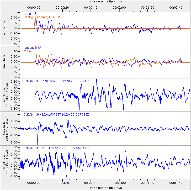
Signal To Noise
| Channel | StoN | STA | LTA |
| CI:DAN: :HHZ:20160723T20:20:25.667988Z | 8.515914 | 6.86513E-7 | 8.061531E-8 |
| CI:DAN: :HHN:20160723T20:20:25.667988Z | 1.1143131 | 1.734352E-7 | 1.5564314E-7 |
| CI:DAN: :HHE:20160723T20:20:25.667988Z | 2.1542003 | 3.691972E-7 | 1.7138481E-7 |
| Arrivals |
| Ps | |
| PpPs | |
| PsPs/PpSs | |


