You are here: Home > Network List > CI - Caltech Regional Seismic Network Stations List
> Station MUR Murrieta > Earthquake Result Viewer
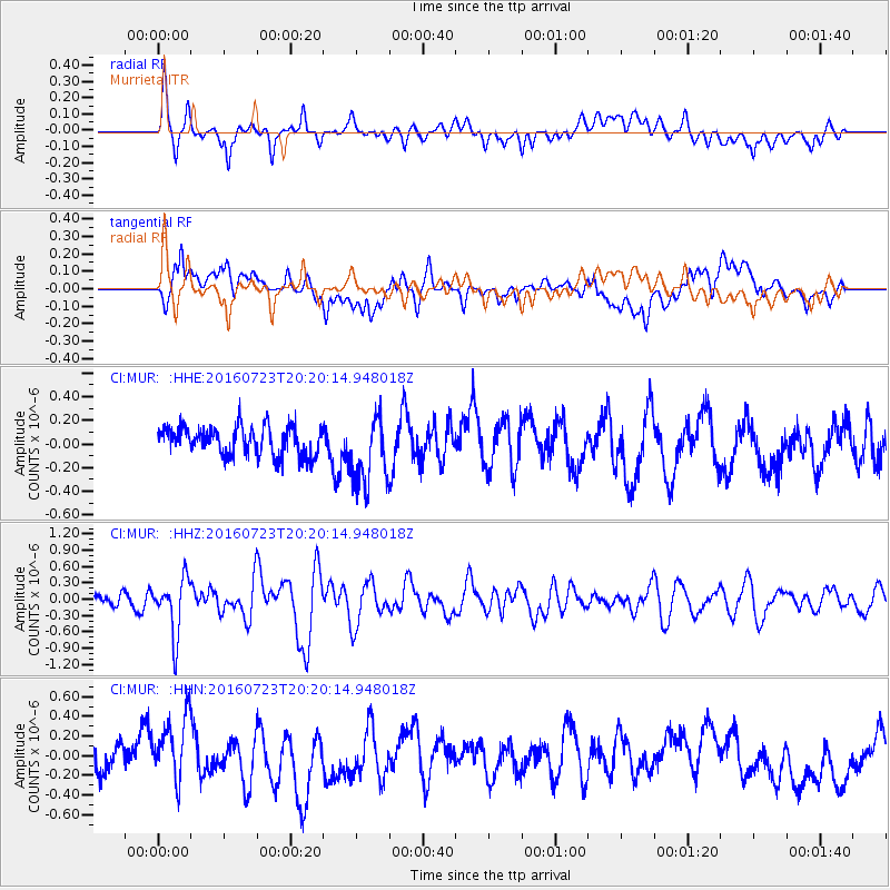
MUR Murrieta - Earthquake Result Viewer
*The percent match for this event was below the threshold and hence no stack was calculated.
| Earthquake location: |
Tonga Islands |
| Earthquake latitude/longitude: |
-15.1/-173.6 |
| Earthquake time(UTC): |
2016/07/23 (205) 20:09:19 GMT |
| Earthquake Depth: |
10 km |
| Earthquake Magnitude: |
5.7 MB |
| Earthquake Catalog/Contributor: |
NEIC PDE/NEIC COMCAT |
|
| Network: |
CI Caltech Regional Seismic Network |
| Station: |
MUR Murrieta |
| Lat/Lon: |
33.60 N/117.20 W |
| Elevation: |
562 m |
|
| Distance: |
72.3 deg |
| Az: |
46.868 deg |
| Baz: |
237.629 deg |
| Ray Param: |
$rayparam |
*The percent match for this event was below the threshold and hence was not used in the summary stack. |
|
| Radial Match: |
73.23071 % |
| Radial Bump: |
400 |
| Transverse Match: |
54.563614 % |
| Transverse Bump: |
400 |
| SOD ConfigId: |
11737051 |
| Insert Time: |
2019-04-25 03:50:28.474 +0000 |
| GWidth: |
2.5 |
| Max Bumps: |
400 |
| Tol: |
0.001 |
|
Signal To Noise
| Channel | StoN | STA | LTA |
| CI:MUR: :HHZ:20160723T20:20:14.948018Z | 5.015975 | 5.0625795E-7 | 1.00929114E-7 |
| CI:MUR: :HHN:20160723T20:20:14.948018Z | 2.6212435 | 3.2445823E-7 | 1.2378027E-7 |
| CI:MUR: :HHE:20160723T20:20:14.948018Z | 2.348875 | 2.824016E-7 | 1.2022845E-7 |
| Arrivals |
| Ps | |
| PpPs | |
| PsPs/PpSs | |


