You are here: Home > Network List > TA - USArray Transportable Network (new EarthScope stations) Stations List
> Station I03D Drain, OR, USA > Earthquake Result Viewer
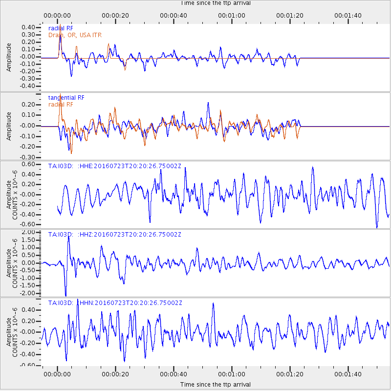
I03D Drain, OR, USA - Earthquake Result Viewer
*The percent match for this event was below the threshold and hence no stack was calculated.
| Earthquake location: |
Tonga Islands |
| Earthquake latitude/longitude: |
-15.1/-173.6 |
| Earthquake time(UTC): |
2016/07/23 (205) 20:09:19 GMT |
| Earthquake Depth: |
10 km |
| Earthquake Magnitude: |
5.7 MB |
| Earthquake Catalog/Contributor: |
NEIC PDE/NEIC COMCAT |
|
| Network: |
TA USArray Transportable Network (new EarthScope stations) |
| Station: |
I03D Drain, OR, USA |
| Lat/Lon: |
43.70 N/123.35 W |
| Elevation: |
140 m |
|
| Distance: |
74.4 deg |
| Az: |
35.402 deg |
| Baz: |
230.488 deg |
| Ray Param: |
$rayparam |
*The percent match for this event was below the threshold and hence was not used in the summary stack. |
|
| Radial Match: |
65.15917 % |
| Radial Bump: |
329 |
| Transverse Match: |
51.95747 % |
| Transverse Bump: |
400 |
| SOD ConfigId: |
11737051 |
| Insert Time: |
2019-04-25 03:54:42.524 +0000 |
| GWidth: |
2.5 |
| Max Bumps: |
400 |
| Tol: |
0.001 |
|
Signal To Noise
| Channel | StoN | STA | LTA |
| TA:I03D: :HHZ:20160723T20:20:26.75002Z | 7.1864634 | 8.383609E-7 | 1.1665834E-7 |
| TA:I03D: :HHN:20160723T20:20:26.75002Z | 1.4419314 | 2.4479584E-7 | 1.6976941E-7 |
| TA:I03D: :HHE:20160723T20:20:26.75002Z | 1.1883157 | 2.1241031E-7 | 1.7874905E-7 |
| Arrivals |
| Ps | |
| PpPs | |
| PsPs/PpSs | |


