You are here: Home > Network List > TA - USArray Transportable Network (new EarthScope stations) Stations List
> Station J26L Joseph Creek, AK, USA > Earthquake Result Viewer
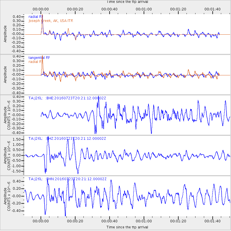
J26L Joseph Creek, AK, USA - Earthquake Result Viewer
*The percent match for this event was below the threshold and hence no stack was calculated.
| Earthquake location: |
Tonga Islands |
| Earthquake latitude/longitude: |
-15.1/-173.6 |
| Earthquake time(UTC): |
2016/07/23 (205) 20:09:19 GMT |
| Earthquake Depth: |
10 km |
| Earthquake Magnitude: |
5.7 MB |
| Earthquake Catalog/Contributor: |
NEIC PDE/NEIC COMCAT |
|
| Network: |
TA USArray Transportable Network (new EarthScope stations) |
| Station: |
J26L Joseph Creek, AK, USA |
| Lat/Lon: |
64.50 N/143.56 W |
| Elevation: |
1144 m |
|
| Distance: |
82.6 deg |
| Az: |
12.629 deg |
| Baz: |
209.203 deg |
| Ray Param: |
$rayparam |
*The percent match for this event was below the threshold and hence was not used in the summary stack. |
|
| Radial Match: |
71.191345 % |
| Radial Bump: |
366 |
| Transverse Match: |
77.62232 % |
| Transverse Bump: |
400 |
| SOD ConfigId: |
11737051 |
| Insert Time: |
2019-04-25 03:54:51.220 +0000 |
| GWidth: |
2.5 |
| Max Bumps: |
400 |
| Tol: |
0.001 |
|
Signal To Noise
| Channel | StoN | STA | LTA |
| TA:J26L: :BHZ:20160723T20:21:12.00002Z | 6.634437 | 8.748095E-7 | 1.3185888E-7 |
| TA:J26L: :BHN:20160723T20:21:12.00002Z | 1.9897872 | 2.4145413E-7 | 1.2134672E-7 |
| TA:J26L: :BHE:20160723T20:21:12.00002Z | 5.2854342 | 2.1208375E-7 | 4.012608E-8 |
| Arrivals |
| Ps | |
| PpPs | |
| PsPs/PpSs | |


