You are here: Home > Network List > TA - USArray Transportable Network (new EarthScope stations) Stations List
> Station P17K Kvichak River, AK, USA > Earthquake Result Viewer
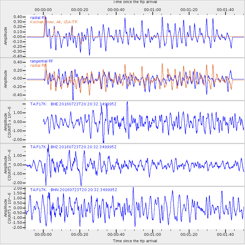
P17K Kvichak River, AK, USA - Earthquake Result Viewer
*The percent match for this event was below the threshold and hence no stack was calculated.
| Earthquake location: |
Tonga Islands |
| Earthquake latitude/longitude: |
-15.1/-173.6 |
| Earthquake time(UTC): |
2016/07/23 (205) 20:09:19 GMT |
| Earthquake Depth: |
10 km |
| Earthquake Magnitude: |
5.7 MB |
| Earthquake Catalog/Contributor: |
NEIC PDE/NEIC COMCAT |
|
| Network: |
TA USArray Transportable Network (new EarthScope stations) |
| Station: |
P17K Kvichak River, AK, USA |
| Lat/Lon: |
59.20 N/156.44 W |
| Elevation: |
91 m |
|
| Distance: |
75.3 deg |
| Az: |
9.043 deg |
| Baz: |
197.157 deg |
| Ray Param: |
$rayparam |
*The percent match for this event was below the threshold and hence was not used in the summary stack. |
|
| Radial Match: |
68.01927 % |
| Radial Bump: |
400 |
| Transverse Match: |
55.07185 % |
| Transverse Bump: |
400 |
| SOD ConfigId: |
11737051 |
| Insert Time: |
2019-04-25 03:55:16.542 +0000 |
| GWidth: |
2.5 |
| Max Bumps: |
400 |
| Tol: |
0.001 |
|
Signal To Noise
| Channel | StoN | STA | LTA |
| TA:P17K: :BHZ:20160723T20:20:32.349995Z | 4.767472 | 1.0775148E-6 | 2.2601385E-7 |
| TA:P17K: :BHN:20160723T20:20:32.349995Z | 1.9475003 | 1.0185377E-6 | 5.229974E-7 |
| TA:P17K: :BHE:20160723T20:20:32.349995Z | 2.111465 | 1.0058642E-6 | 4.7638213E-7 |
| Arrivals |
| Ps | |
| PpPs | |
| PsPs/PpSs | |


