You are here: Home > Network List > UW - Pacific Northwest Regional Seismic Network Stations List
> Station LCCR Mulino, OR, USA > Earthquake Result Viewer
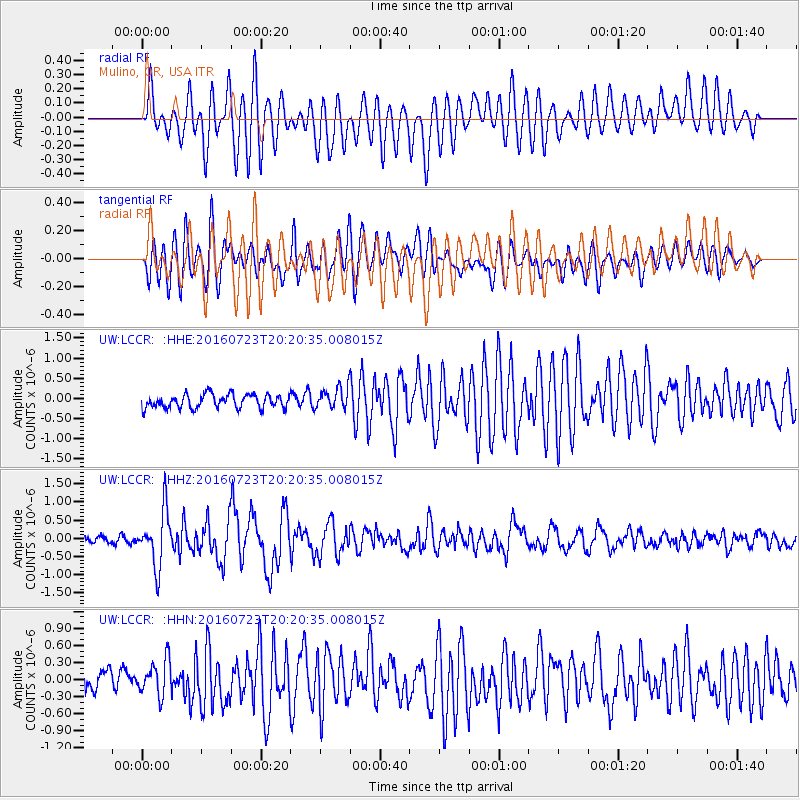
LCCR Mulino, OR, USA - Earthquake Result Viewer
*The percent match for this event was below the threshold and hence no stack was calculated.
| Earthquake location: |
Tonga Islands |
| Earthquake latitude/longitude: |
-15.1/-173.6 |
| Earthquake time(UTC): |
2016/07/23 (205) 20:09:19 GMT |
| Earthquake Depth: |
10 km |
| Earthquake Magnitude: |
5.7 MB |
| Earthquake Catalog/Contributor: |
NEIC PDE/NEIC COMCAT |
|
| Network: |
UW Pacific Northwest Regional Seismic Network |
| Station: |
LCCR Mulino, OR, USA |
| Lat/Lon: |
45.21 N/122.48 W |
| Elevation: |
273 m |
|
| Distance: |
75.8 deg |
| Az: |
34.603 deg |
| Baz: |
230.89 deg |
| Ray Param: |
$rayparam |
*The percent match for this event was below the threshold and hence was not used in the summary stack. |
|
| Radial Match: |
79.25263 % |
| Radial Bump: |
400 |
| Transverse Match: |
75.96313 % |
| Transverse Bump: |
400 |
| SOD ConfigId: |
11737051 |
| Insert Time: |
2019-04-25 03:56:14.096 +0000 |
| GWidth: |
2.5 |
| Max Bumps: |
400 |
| Tol: |
0.001 |
|
Signal To Noise
| Channel | StoN | STA | LTA |
| UW:LCCR: :HHZ:20160723T20:20:35.008015Z | 7.9939427 | 7.560264E-7 | 9.457491E-8 |
| UW:LCCR: :HHN:20160723T20:20:35.008015Z | 2.2375336 | 3.0880176E-7 | 1.3800988E-7 |
| UW:LCCR: :HHE:20160723T20:20:35.008015Z | 1.4057922 | 2.3916712E-7 | 1.7012978E-7 |
| Arrivals |
| Ps | |
| PpPs | |
| PsPs/PpSs | |


