You are here: Home > Network List > LD - Lamont-Doherty Cooperative Seismographic Network Stations List
> Station MVL Millersville University, PA > Earthquake Result Viewer
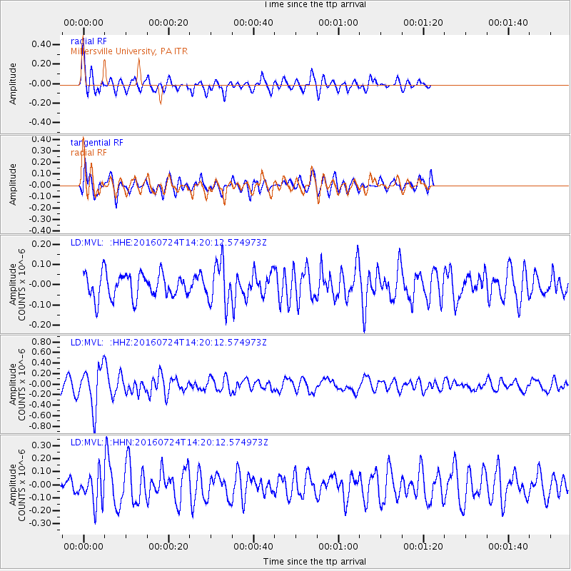
MVL Millersville University, PA - Earthquake Result Viewer
*The percent match for this event was below the threshold and hence no stack was calculated.
| Earthquake location: |
Central Mid-Atlantic Ridge |
| Earthquake latitude/longitude: |
0.9/-29.0 |
| Earthquake time(UTC): |
2016/07/24 (206) 14:10:51 GMT |
| Earthquake Depth: |
10 km |
| Earthquake Magnitude: |
5.7 mwb |
| Earthquake Catalog/Contributor: |
NEIC PDE/ |
|
| Network: |
LD Lamont-Doherty Cooperative Seismographic Network |
| Station: |
MVL Millersville University, PA |
| Lat/Lon: |
40.00 N/76.35 W |
| Elevation: |
91 m |
|
| Distance: |
58.0 deg |
| Az: |
318.186 deg |
| Baz: |
119.794 deg |
| Ray Param: |
$rayparam |
*The percent match for this event was below the threshold and hence was not used in the summary stack. |
|
| Radial Match: |
68.52464 % |
| Radial Bump: |
400 |
| Transverse Match: |
62.081715 % |
| Transverse Bump: |
400 |
| SOD ConfigId: |
11737051 |
| Insert Time: |
2019-04-25 04:03:51.913 +0000 |
| GWidth: |
2.5 |
| Max Bumps: |
400 |
| Tol: |
0.001 |
|
Signal To Noise
| Channel | StoN | STA | LTA |
| LD:MVL: :HHZ:20160724T14:20:12.574973Z | 3.4020567 | 3.9418535E-7 | 1.15866776E-7 |
| LD:MVL: :HHN:20160724T14:20:12.574973Z | 1.7765685 | 1.1995006E-7 | 6.751784E-8 |
| LD:MVL: :HHE:20160724T14:20:12.574973Z | 1.7466347 | 1.0423186E-7 | 5.967582E-8 |
| Arrivals |
| Ps | |
| PpPs | |
| PsPs/PpSs | |


