You are here: Home > Network List > TA - USArray Transportable Network (new EarthScope stations) Stations List
> Station L44A Lake County Forest Preserve, Grayslake, IL, USA > Earthquake Result Viewer
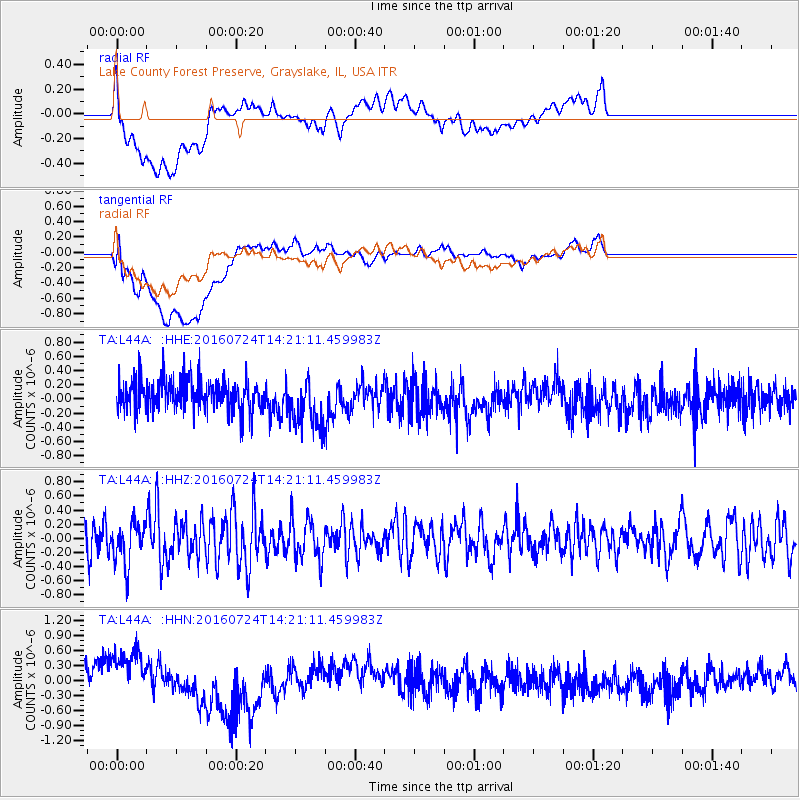
L44A Lake County Forest Preserve, Grayslake, IL, USA - Earthquake Result Viewer
*The percent match for this event was below the threshold and hence no stack was calculated.
| Earthquake location: |
Central Mid-Atlantic Ridge |
| Earthquake latitude/longitude: |
0.9/-29.0 |
| Earthquake time(UTC): |
2016/07/24 (206) 14:10:51 GMT |
| Earthquake Depth: |
10 km |
| Earthquake Magnitude: |
5.7 mwb |
| Earthquake Catalog/Contributor: |
NEIC PDE/ |
|
| Network: |
TA USArray Transportable Network (new EarthScope stations) |
| Station: |
L44A Lake County Forest Preserve, Grayslake, IL, USA |
| Lat/Lon: |
42.18 N/87.91 W |
| Elevation: |
202 m |
|
| Distance: |
66.8 deg |
| Az: |
316.148 deg |
| Baz: |
111.262 deg |
| Ray Param: |
$rayparam |
*The percent match for this event was below the threshold and hence was not used in the summary stack. |
|
| Radial Match: |
45.66681 % |
| Radial Bump: |
400 |
| Transverse Match: |
50.97711 % |
| Transverse Bump: |
400 |
| SOD ConfigId: |
11737051 |
| Insert Time: |
2019-04-25 04:08:06.067 +0000 |
| GWidth: |
2.5 |
| Max Bumps: |
400 |
| Tol: |
0.001 |
|
Signal To Noise
| Channel | StoN | STA | LTA |
| TA:L44A: :HHZ:20160724T14:21:11.459983Z | 1.2316983 | 2.8480503E-7 | 2.3122955E-7 |
| TA:L44A: :HHN:20160724T14:21:11.459983Z | 2.0176928 | 5.6369487E-7 | 2.7937597E-7 |
| TA:L44A: :HHE:20160724T14:21:11.459983Z | 1.65814 | 3.5804337E-7 | 2.1593071E-7 |
| Arrivals |
| Ps | |
| PpPs | |
| PsPs/PpSs | |


