You are here: Home > Network List > US - United States National Seismic Network Stations List
> Station WMOK Wichita Mountains, Oklahoma, USA > Earthquake Result Viewer
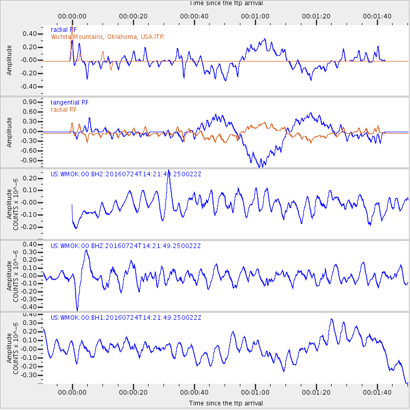
WMOK Wichita Mountains, Oklahoma, USA - Earthquake Result Viewer
*The percent match for this event was below the threshold and hence no stack was calculated.
| Earthquake location: |
Central Mid-Atlantic Ridge |
| Earthquake latitude/longitude: |
0.9/-29.0 |
| Earthquake time(UTC): |
2016/07/24 (206) 14:10:51 GMT |
| Earthquake Depth: |
10 km |
| Earthquake Magnitude: |
5.7 mwb |
| Earthquake Catalog/Contributor: |
NEIC PDE/ |
|
| Network: |
US United States National Seismic Network |
| Station: |
WMOK Wichita Mountains, Oklahoma, USA |
| Lat/Lon: |
34.74 N/98.78 W |
| Elevation: |
486 m |
|
| Distance: |
73.0 deg |
| Az: |
306.052 deg |
| Baz: |
101.016 deg |
| Ray Param: |
$rayparam |
*The percent match for this event was below the threshold and hence was not used in the summary stack. |
|
| Radial Match: |
50.425526 % |
| Radial Bump: |
400 |
| Transverse Match: |
34.305096 % |
| Transverse Bump: |
400 |
| SOD ConfigId: |
11737051 |
| Insert Time: |
2019-04-25 04:09:04.755 +0000 |
| GWidth: |
2.5 |
| Max Bumps: |
400 |
| Tol: |
0.001 |
|
Signal To Noise
| Channel | StoN | STA | LTA |
| US:WMOK:00:BHZ:20160724T14:21:49.250022Z | 3.7576075 | 2.1666739E-7 | 5.7660994E-8 |
| US:WMOK:00:BH1:20160724T14:21:49.250022Z | 0.87525177 | 1.1976533E-7 | 1.368353E-7 |
| US:WMOK:00:BH2:20160724T14:21:49.250022Z | 1.828204 | 1.3230277E-7 | 7.236762E-8 |
| Arrivals |
| Ps | |
| PpPs | |
| PsPs/PpSs | |


