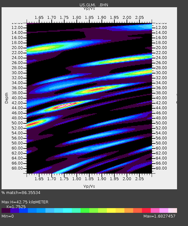
GLMI Grayling, Michigan, USA - Earthquake Result Viewer
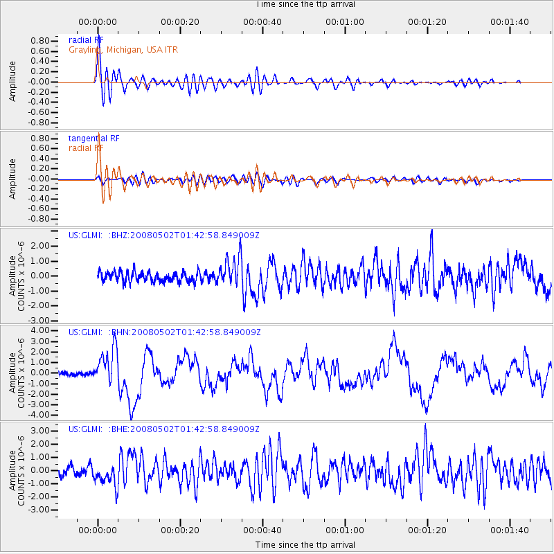
Earthquake location: Andreanof Islands, Aleutian Is.
Earthquake latitude/longitude: 51.9/-177.5
Earthquake time(UTC): 2008/05/02 (123) 01:33:37 GMT
Earthquake Depth: 14 km
Earthquake Magnitude: 6.3 MB, 6.8 MS, 6.6 MW, 6.6 MW
Earthquake Catalog/Contributor: WHDF/NEIC
Network: US United States National Seismic Network
Station: GLMI Grayling, Michigan, USA
Lat/Lon: 44.82 N/84.62 W
Elevation: 387 m
Distance: 58.1 deg
Az: 56.861 deg
Baz: 313.144 deg
Ray Param: 0.063069835
Estimated Moho Depth: 42.75 km
Estimated Crust Vp/Vs: 1.75
Assumed Crust Vp: 6.483 km/s
Estimated Crust Vs: 3.699 km/s
Estimated Crust Poisson's Ratio: 0.26
Radial Match: 86.35534 %
Radial Bump: 400
Transverse Match: 58.405563 %
Transverse Bump: 400
SOD ConfigId: 2504
Insert Time: 2010-03-05 05:42:30.499 +0000
GWidth: 2.5
Max Bumps: 400
Tol: 0.001

Signal To Noise

ChannelStoNSTALTA
US:GLMI: :BHN:20080502T01:42:58.849009Z9.553581.7889997E-61.8725962E-7
US:GLMI: :BHE:20080502T01:42:58.849009Z2.2243168.4790366E-73.811975E-7
US:GLMI: :BHZ:20080502T01:42:58.849009Z2.98019.746221E-73.2704344E-7
Arrivals
Ps5.2 SECOND
PpPs17 SECOND
PsPs/PpSs22 SECOND