You are here: Home > Network List > US - United States National Seismic Network Stations List
> Station GLMI Grayling, Michigan, USA > Earthquake Result Viewer
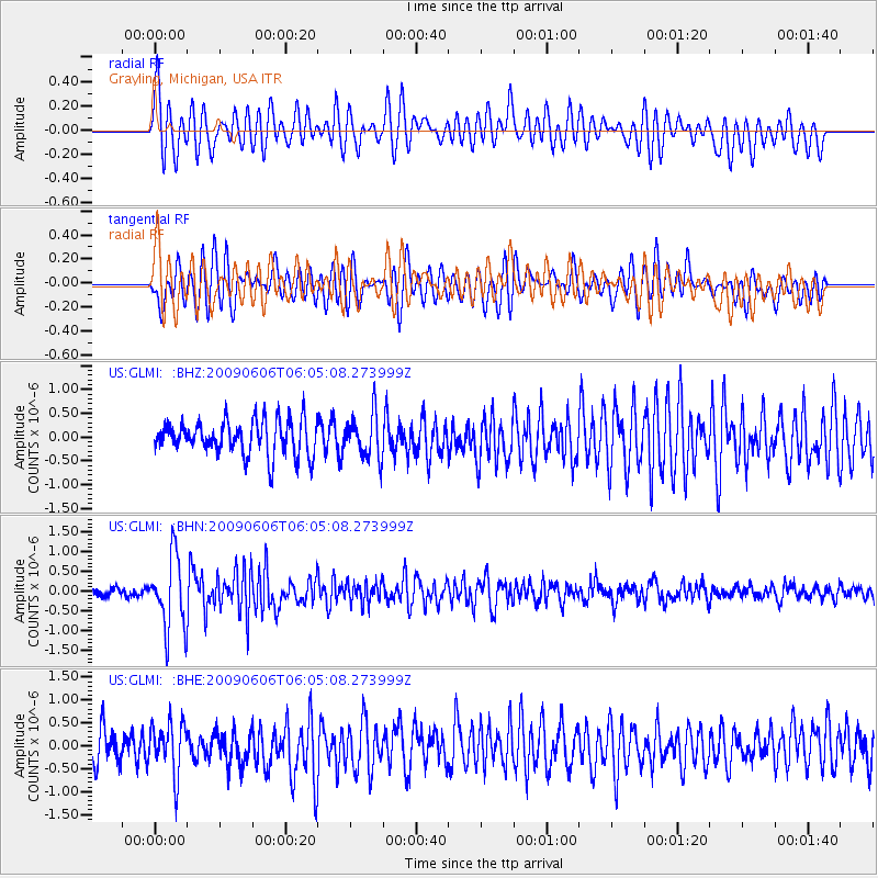
GLMI Grayling, Michigan, USA - Earthquake Result Viewer
*The percent match for this event was below the threshold and hence no stack was calculated.
| Earthquake location: |
Near East Coast Of Honshu, Japan |
| Earthquake latitude/longitude: |
35.5/140.9 |
| Earthquake time(UTC): |
2009/06/06 (157) 05:52:43 GMT |
| Earthquake Depth: |
34 km |
| Earthquake Magnitude: |
5.8 MB, 5.4 MS, 5.8 MW, 5.7 MW |
| Earthquake Catalog/Contributor: |
WHDF/NEIC |
|
| Network: |
US United States National Seismic Network |
| Station: |
GLMI Grayling, Michigan, USA |
| Lat/Lon: |
44.82 N/84.62 W |
| Elevation: |
387 m |
|
| Distance: |
90.0 deg |
| Az: |
30.52 deg |
| Baz: |
324.379 deg |
| Ray Param: |
$rayparam |
*The percent match for this event was below the threshold and hence was not used in the summary stack. |
|
| Radial Match: |
65.81656 % |
| Radial Bump: |
400 |
| Transverse Match: |
61.335426 % |
| Transverse Bump: |
400 |
| SOD ConfigId: |
2648 |
| Insert Time: |
2010-03-05 05:43:30.265 +0000 |
| GWidth: |
2.5 |
| Max Bumps: |
400 |
| Tol: |
0.001 |
|
Signal To Noise
| Channel | StoN | STA | LTA |
| US:GLMI: :BHN:20090606T06:05:08.273999Z | 6.1191854 | 9.1131824E-7 | 1.4892802E-7 |
| US:GLMI: :BHE:20090606T06:05:08.273999Z | 1.3055117 | 5.652851E-7 | 4.3299892E-7 |
| US:GLMI: :BHZ:20090606T06:05:08.273999Z | 1.2891929 | 4.6135946E-7 | 3.578669E-7 |
| Arrivals |
| Ps | |
| PpPs | |
| PsPs/PpSs | |


