You are here: Home > Network List > US - United States National Seismic Network Stations List
> Station GLMI Grayling, Michigan, USA > Earthquake Result Viewer
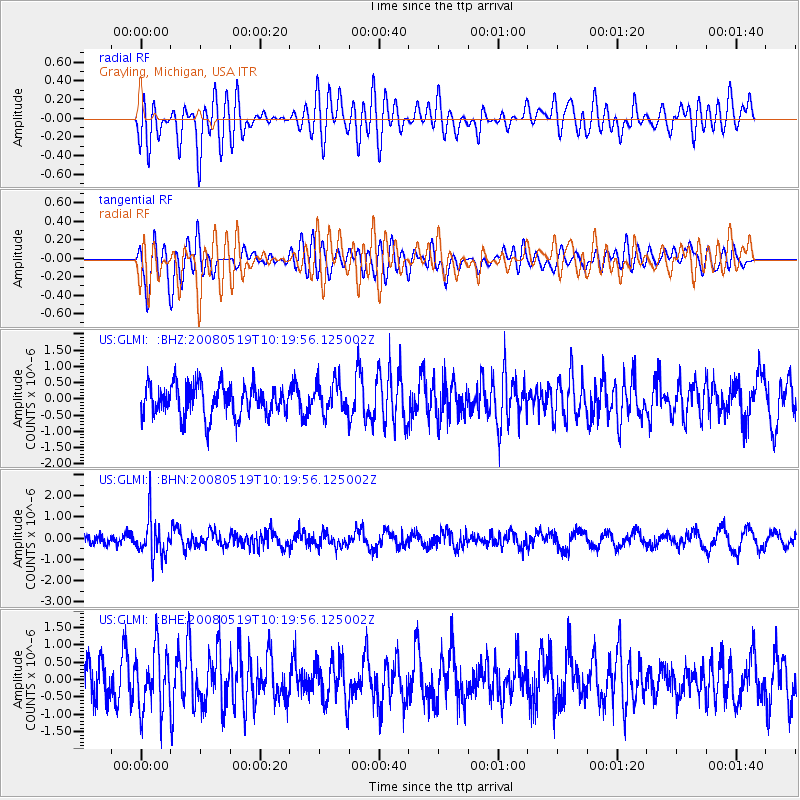
GLMI Grayling, Michigan, USA - Earthquake Result Viewer
*The percent match for this event was below the threshold and hence no stack was calculated.
| Earthquake location: |
E. Russia-N.E. China Border Reg. |
| Earthquake latitude/longitude: |
42.5/131.9 |
| Earthquake time(UTC): |
2008/05/19 (140) 10:08:36 GMT |
| Earthquake Depth: |
513 km |
| Earthquake Magnitude: |
5.7 MW, 5.4 MB, 5.6 MW |
| Earthquake Catalog/Contributor: |
WHDF/NEIC |
|
| Network: |
US United States National Seismic Network |
| Station: |
GLMI Grayling, Michigan, USA |
| Lat/Lon: |
44.82 N/84.62 W |
| Elevation: |
387 m |
|
| Distance: |
87.1 deg |
| Az: |
25.069 deg |
| Baz: |
333.877 deg |
| Ray Param: |
$rayparam |
*The percent match for this event was below the threshold and hence was not used in the summary stack. |
|
| Radial Match: |
50.989704 % |
| Radial Bump: |
400 |
| Transverse Match: |
68.9705 % |
| Transverse Bump: |
400 |
| SOD ConfigId: |
2504 |
| Insert Time: |
2010-03-05 05:43:42.149 +0000 |
| GWidth: |
2.5 |
| Max Bumps: |
400 |
| Tol: |
0.001 |
|
Signal To Noise
| Channel | StoN | STA | LTA |
| US:GLMI: :BHN:20080519T10:19:56.125002Z | 4.0215926 | 9.1515955E-7 | 2.2756147E-7 |
| US:GLMI: :BHE:20080519T10:19:56.125002Z | 1.6372341 | 8.8029236E-7 | 5.376704E-7 |
| US:GLMI: :BHZ:20080519T10:19:56.125002Z | 1.0147504 | 4.8749894E-7 | 4.804127E-7 |
| Arrivals |
| Ps | |
| PpPs | |
| PsPs/PpSs | |


