You are here: Home > Network List > GS - US Geological Survey Networks Stations List
> Station DEC12 Decatur Surface Seismic Site, Decatur, IL, USA > Earthquake Result Viewer
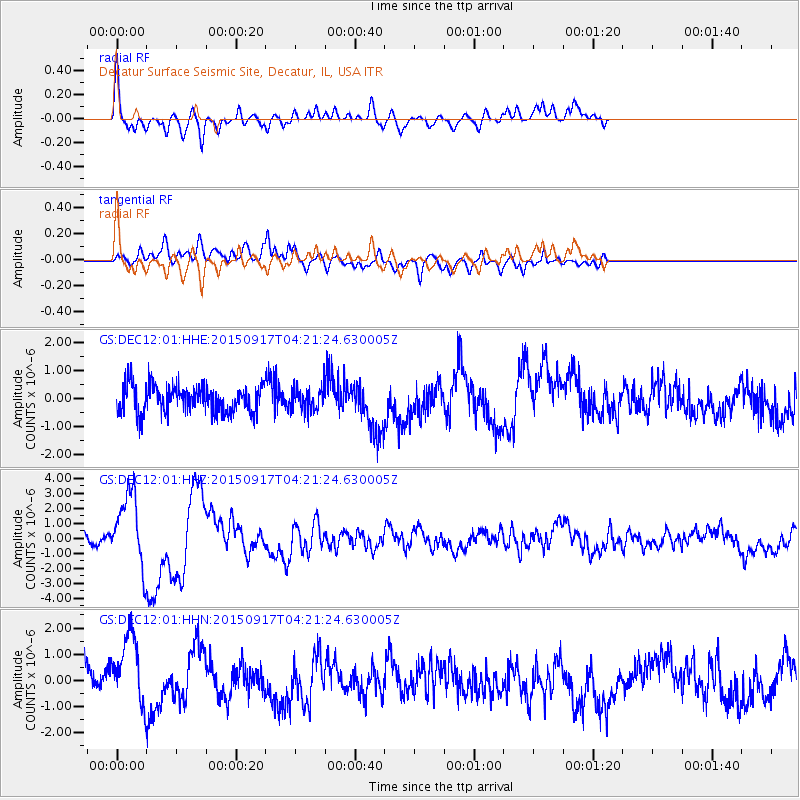
DEC12 Decatur Surface Seismic Site, Decatur, IL, USA - Earthquake Result Viewer
*The percent match for this event was below the threshold and hence no stack was calculated.
| Earthquake location: |
Near Coast Of Central Chile |
| Earthquake latitude/longitude: |
-31.5/-71.8 |
| Earthquake time(UTC): |
2015/09/17 (260) 04:10:31 GMT |
| Earthquake Depth: |
40 km |
| Earthquake Magnitude: |
6.3 MB |
| Earthquake Catalog/Contributor: |
NEIC PDE/NEIC COMCAT |
|
| Network: |
GS US Geological Survey Networks |
| Station: |
DEC12 Decatur Surface Seismic Site, Decatur, IL, USA |
| Lat/Lon: |
39.91 N/88.91 W |
| Elevation: |
208 m |
|
| Distance: |
72.8 deg |
| Az: |
346.278 deg |
| Baz: |
164.732 deg |
| Ray Param: |
$rayparam |
*The percent match for this event was below the threshold and hence was not used in the summary stack. |
|
| Radial Match: |
76.25979 % |
| Radial Bump: |
400 |
| Transverse Match: |
64.370415 % |
| Transverse Bump: |
400 |
| SOD ConfigId: |
1156111 |
| Insert Time: |
2015-10-01 04:32:21.305 +0000 |
| GWidth: |
2.5 |
| Max Bumps: |
400 |
| Tol: |
0.001 |
|
Signal To Noise
| Channel | StoN | STA | LTA |
| GS:DEC12:01:HHZ:20150917T04:21:24.630005Z | 7.5245357 | 2.422269E-6 | 3.2191608E-7 |
| GS:DEC12:01:HHN:20150917T04:21:24.630005Z | 2.1872685 | 1.3826182E-6 | 6.3212093E-7 |
| GS:DEC12:01:HHE:20150917T04:21:24.630005Z | 0.8455685 | 4.0932895E-7 | 4.840873E-7 |
| Arrivals |
| Ps | |
| PpPs | |
| PsPs/PpSs | |


