NATX Nacogdoches, Texas, USA - Earthquake Result Viewer
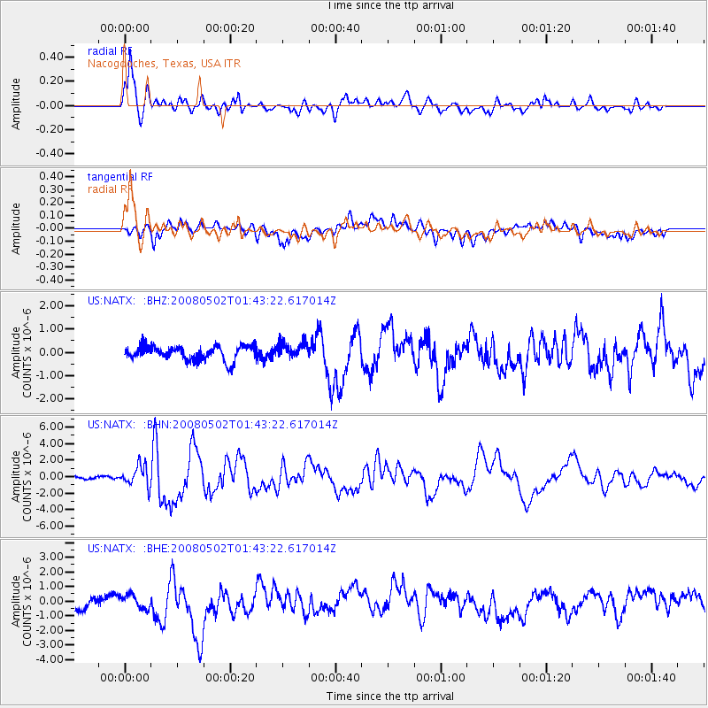
Earthquake location: Andreanof Islands, Aleutian Is.
Earthquake latitude/longitude: 51.9/-177.5
Earthquake time(UTC): 2008/05/02 (123) 01:33:37 GMT
Earthquake Depth: 14 km
Earthquake Magnitude: 6.3 MB, 6.8 MS, 6.6 MW, 6.6 MW
Earthquake Catalog/Contributor: WHDF/NEIC
Network: US United States National Seismic Network
Station: NATX Nacogdoches, Texas, USA
Lat/Lon: 31.76 N/94.66 W
Elevation: 156 m
Distance: 61.5 deg
Az: 74.034 deg
Baz: 315.584 deg
Ray Param: 0.060799193
Estimated Moho Depth: 10.0 km
Estimated Crust Vp/Vs: 1.60
Assumed Crust Vp: 5.738 km/s
Estimated Crust Vs: 3.587 km/s
Estimated Crust Poisson's Ratio: 0.18
Radial Match: 81.83416 %
Radial Bump: 400
Transverse Match: 59.807217 %
Transverse Bump: 400
SOD ConfigId: 2504
Insert Time: 2010-03-05 05:44:02.807 +0000
GWidth: 2.5
Max Bumps: 400
Tol: 0.001

Signal To Noise

ChannelStoNSTALTA
US:NATX: :BHN:20080502T01:43:22.617014Z7.04108761.259004E-61.7880818E-7
US:NATX: :BHE:20080502T01:43:22.617014Z0.879212865.2757514E-76.000539E-7
US:NATX: :BHZ:20080502T01:43:22.617014Z1.14997423.5195364E-73.0605352E-7
Arrivals
Ps1.1 SECOND
PpPs4.4 SECOND
PsPs/PpSs5.4 SECOND