You are here: Home > Network List > US - United States National Seismic Network Stations List
> Station NATX Nacogdoches, Texas, USA > Earthquake Result Viewer
NATX Nacogdoches, Texas, USA - Earthquake Result Viewer

| Earthquake location: |
South Of Fiji Islands |
| Earthquake latitude/longitude: |
-25.5/-176.4 |
| Earthquake time(UTC): |
2008/07/06 (188) 04:30:26 GMT |
| Earthquake Depth: |
49 km |
| Earthquake Magnitude: |
5.5 MB, 5.3 MS |
| Earthquake Catalog/Contributor: |
WHDF/NEIC |
|
| Network: |
US United States National Seismic Network |
| Station: |
NATX Nacogdoches, Texas, USA |
| Lat/Lon: |
31.76 N/94.66 W |
| Elevation: |
156 m |
|
| Distance: |
96.5 deg |
| Az: |
58.027 deg |
| Baz: |
244.19 deg |
| Ray Param: |
0.040475946 |
| Estimated Moho Depth: |
55.25 km |
| Estimated Crust Vp/Vs: |
1.73 |
| Assumed Crust Vp: |
5.738 km/s |
| Estimated Crust Vs: |
3.327 km/s |
| Estimated Crust Poisson's Ratio: |
0.25 |
|
| Radial Match: |
99.142685 % |
| Radial Bump: |
97 |
| Transverse Match: |
97.977104 % |
| Transverse Bump: |
123 |
| SOD ConfigId: |
2504 |
| Insert Time: |
2010-03-05 05:44:04.324 +0000 |
| GWidth: |
2.5 |
| Max Bumps: |
400 |
| Tol: |
0.001 |
|
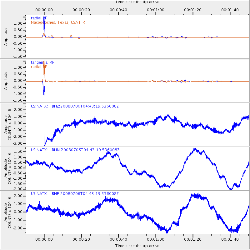
Signal To Noise
| Channel | StoN | STA | LTA |
| US:NATX: :BHN:20080706T04:43:19.536008Z | 0.9142098 | 1.3946708E-6 | 1.5255479E-6 |
| US:NATX: :BHE:20080706T04:43:19.536008Z | 0.8891961 | 1.6018637E-6 | 1.8014741E-6 |
| US:NATX: :BHZ:20080706T04:43:19.536008Z | 0.9200324 | 9.82626E-7 | 1.0680342E-6 |
| Arrivals |
| Ps | 7.1 SECOND |
| PpPs | 26 SECOND |
| PsPs/PpSs | 33 SECOND |


