You are here: Home > Network List > US - United States National Seismic Network Stations List
> Station NATX Nacogdoches, Texas, USA > Earthquake Result Viewer
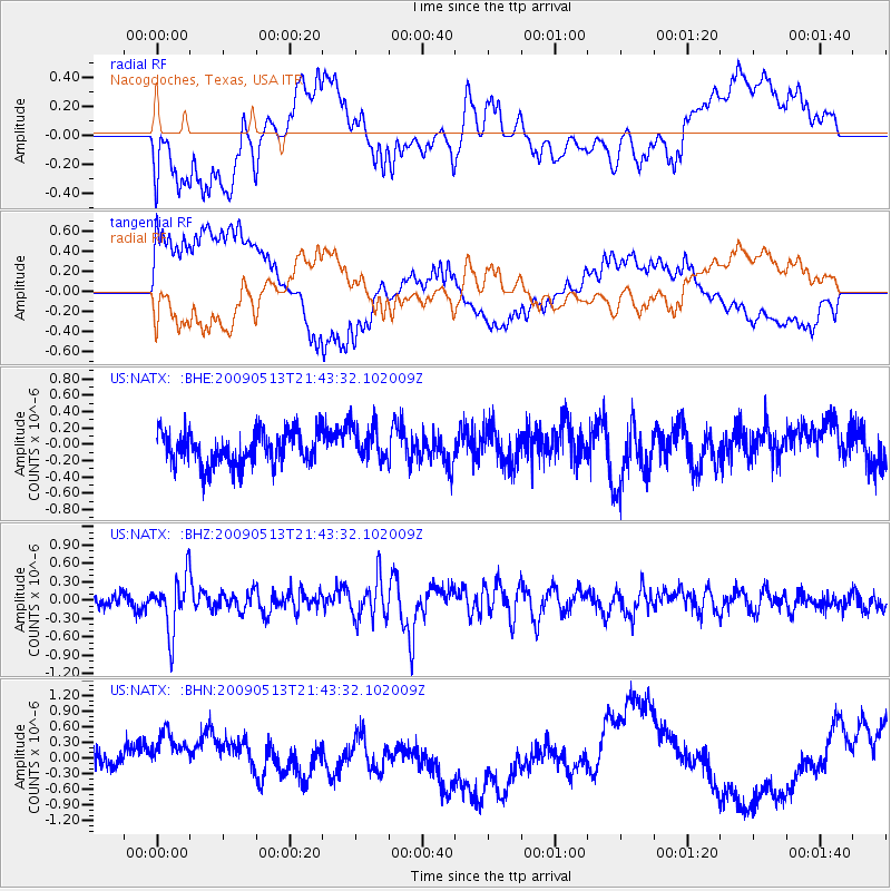
NATX Nacogdoches, Texas, USA - Earthquake Result Viewer
*The percent match for this event was below the threshold and hence no stack was calculated.
| Earthquake location: |
Tonga Islands |
| Earthquake latitude/longitude: |
-15.8/-173.5 |
| Earthquake time(UTC): |
2009/05/13 (133) 21:31:17 GMT |
| Earthquake Depth: |
85 km |
| Earthquake Magnitude: |
5.8 MW, 5.3 MB, 5.8 MW |
| Earthquake Catalog/Contributor: |
WHDF/NEIC |
|
| Network: |
US United States National Seismic Network |
| Station: |
NATX Nacogdoches, Texas, USA |
| Lat/Lon: |
31.76 N/94.66 W |
| Elevation: |
156 m |
|
| Distance: |
89.0 deg |
| Az: |
56.702 deg |
| Baz: |
250.879 deg |
| Ray Param: |
$rayparam |
*The percent match for this event was below the threshold and hence was not used in the summary stack. |
|
| Radial Match: |
53.224064 % |
| Radial Bump: |
400 |
| Transverse Match: |
54.510696 % |
| Transverse Bump: |
400 |
| SOD ConfigId: |
2760 |
| Insert Time: |
2010-03-05 05:44:41.035 +0000 |
| GWidth: |
2.5 |
| Max Bumps: |
400 |
| Tol: |
0.001 |
|
Signal To Noise
| Channel | StoN | STA | LTA |
| US:NATX: :BHZ:20090513T21:43:32.102009Z | 3.48571 | 4.4939236E-7 | 1.289242E-7 |
| US:NATX: :BHN:20090513T21:43:32.102009Z | 0.9155559 | 3.592591E-7 | 3.923945E-7 |
| US:NATX: :BHE:20090513T21:43:32.102009Z | 1.0754656 | 2.1068114E-7 | 1.9589761E-7 |
| Arrivals |
| Ps | |
| PpPs | |
| PsPs/PpSs | |


