You are here: Home > Network List > US - United States National Seismic Network Stations List
> Station BINY Binghamton, New York, USA > Earthquake Result Viewer
BINY Binghamton, New York, USA - Earthquake Result Viewer

| Earthquake location: |
East Of Kuril Islands |
| Earthquake latitude/longitude: |
46.4/154.5 |
| Earthquake time(UTC): |
2006/11/16 (320) 06:20:20 GMT |
| Earthquake Depth: |
9.0 km |
| Earthquake Magnitude: |
6.0 MB, 5.4 MS, 5.9 MW, 5.9 MW |
| Earthquake Catalog/Contributor: |
WHDF/NEIC |
|
| Network: |
US United States National Seismic Network |
| Station: |
BINY Binghamton, New York, USA |
| Lat/Lon: |
42.20 N/75.99 W |
| Elevation: |
498 m |
|
| Distance: |
81.1 deg |
| Az: |
35.45 deg |
| Baz: |
327.276 deg |
| Ray Param: |
0.047841564 |
| Estimated Moho Depth: |
10.0 km |
| Estimated Crust Vp/Vs: |
1.60 |
| Assumed Crust Vp: |
6.419 km/s |
| Estimated Crust Vs: |
4.012 km/s |
| Estimated Crust Poisson's Ratio: |
0.18 |
|
| Radial Match: |
99.91651 % |
| Radial Bump: |
12 |
| Transverse Match: |
94.58608 % |
| Transverse Bump: |
89 |
| SOD ConfigId: |
2564 |
| Insert Time: |
2010-03-05 05:47:48.889 +0000 |
| GWidth: |
2.5 |
| Max Bumps: |
400 |
| Tol: |
0.001 |
|
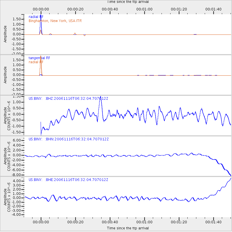
Signal To Noise
| Channel | StoN | STA | LTA |
| US:BINY: :BHN:20061116T06:32:04.707012Z | 0.9948194 | 6.6699226E-7 | 6.7046574E-7 |
| US:BINY: :BHE:20061116T06:32:04.707012Z | 0.71873057 | 3.6257885E-7 | 5.044712E-7 |
| US:BINY: :BHZ:20061116T06:32:04.707012Z | 1.6099424 | 8.631241E-7 | 5.3612115E-7 |
| Arrivals |
| Ps | 1.0 SECOND |
| PpPs | 3.9 SECOND |
| PsPs/PpSs | 4.9 SECOND |


