You are here: Home > Network List > AV - Alaska Volcano Observatory Stations List
> Station AUJA Augustine Junction, Augustine Volcano, Alaska > Earthquake Result Viewer
AUJA Augustine Junction, Augustine Volcano, Alaska - Earthquake Result Viewer

| Earthquake location: |
Mariana Islands |
| Earthquake latitude/longitude: |
18.5/145.5 |
| Earthquake time(UTC): |
2016/07/29 (211) 21:18:25 GMT |
| Earthquake Depth: |
212 km |
| Earthquake Magnitude: |
7.7 MWW, 7.7 MWB, 7.7 MI |
| Earthquake Catalog/Contributor: |
NEIC PDE/NEIC COMCAT |
|
| Network: |
AV Alaska Volcano Observatory |
| Station: |
AUJA Augustine Junction, Augustine Volcano, Alaska |
| Lat/Lon: |
59.34 N/153.42 W |
| Elevation: |
376 m |
|
| Distance: |
59.6 deg |
| Az: |
31.337 deg |
| Baz: |
254.346 deg |
| Ray Param: |
0.06140735 |
| Estimated Moho Depth: |
13.75 km |
| Estimated Crust Vp/Vs: |
1.98 |
| Assumed Crust Vp: |
5.989 km/s |
| Estimated Crust Vs: |
3.025 km/s |
| Estimated Crust Poisson's Ratio: |
0.33 |
|
| Radial Match: |
86.05258 % |
| Radial Bump: |
400 |
| Transverse Match: |
66.164894 % |
| Transverse Bump: |
400 |
| SOD ConfigId: |
11737051 |
| Insert Time: |
2019-04-25 04:55:03.076 +0000 |
| GWidth: |
2.5 |
| Max Bumps: |
400 |
| Tol: |
0.001 |
|
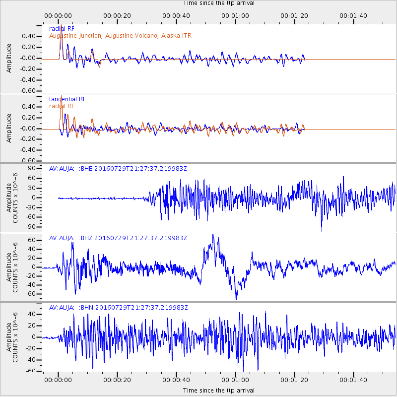
Signal To Noise
| Channel | StoN | STA | LTA |
| AV:AUJA: :BHZ:20160729T21:27:37.219983Z | 50.437386 | 2.0248763E-5 | 4.0146335E-7 |
| AV:AUJA: :BHN:20160729T21:27:37.219983Z | 12.212032 | 9.374311E-6 | 7.676291E-7 |
| AV:AUJA: :BHE:20160729T21:27:37.219983Z | 10.10994 | 1.0051186E-5 | 9.941886E-7 |
| Arrivals |
| Ps | 2.3 SECOND |
| PpPs | 6.6 SECOND |
| PsPs/PpSs | 8.9 SECOND |


