BINY Binghamton, New York, USA - Earthquake Result Viewer
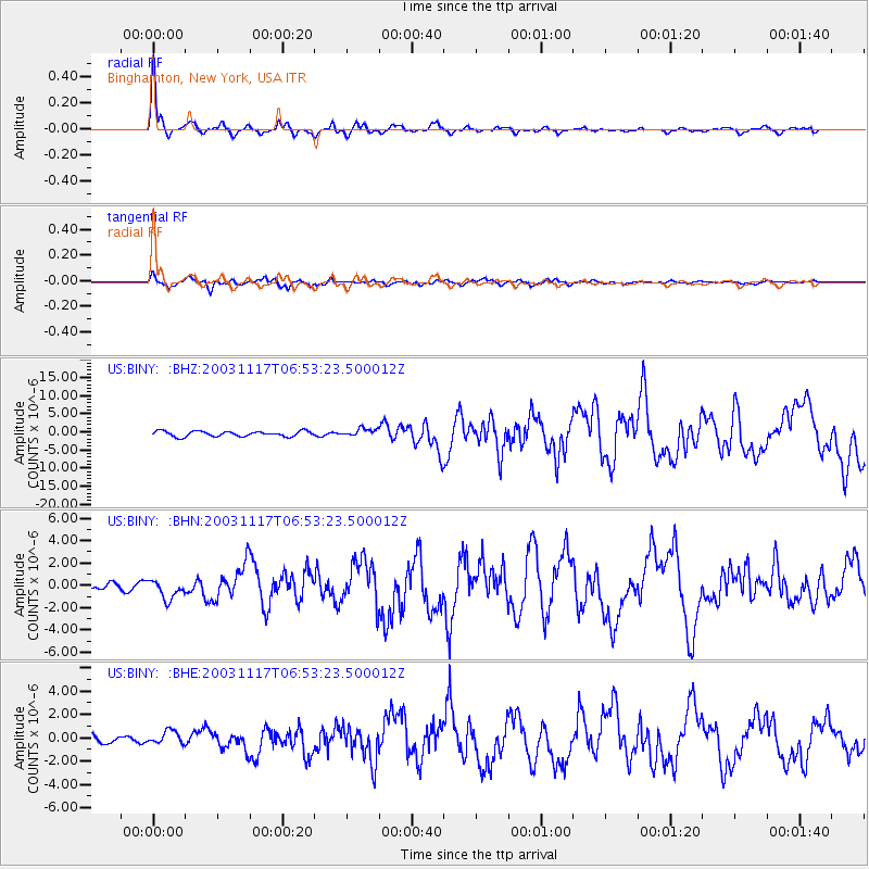
Earthquake location: Rat Islands, Aleutian Islands
Earthquake latitude/longitude: 51.1/178.6
Earthquake time(UTC): 2003/11/17 (321) 06:43:06 GMT
Earthquake Depth: 33 km
Earthquake Magnitude: 6.2 MB, 7.2 MS, 7.8 MW, 7.7 MW
Earthquake Catalog/Contributor: WHDF/NEIC
Network: US United States National Seismic Network
Station: BINY Binghamton, New York, USA
Lat/Lon: 42.20 N/75.99 W
Elevation: 498 m
Distance: 66.7 deg
Az: 51.279 deg
Baz: 318.594 deg
Ray Param: 0.05739909
Estimated Moho Depth: 48.0 km
Estimated Crust Vp/Vs: 1.73
Assumed Crust Vp: 6.419 km/s
Estimated Crust Vs: 3.721 km/s
Estimated Crust Poisson's Ratio: 0.25
Radial Match: 95.71014 %
Radial Bump: 379
Transverse Match: 80.46875 %
Transverse Bump: 400
SOD ConfigId: 110177
Insert Time: 2010-03-05 05:49:53.518 +0000
GWidth: 2.5
Max Bumps: 400
Tol: 0.001

Signal To Noise

ChannelStoNSTALTA
US:BINY: :BHN:20031117T06:53:23.500012Z2.771748.6528144E-73.1217988E-7
US:BINY: :BHE:20031117T06:53:23.500012Z1.03188185.548992E-75.377546E-7
US:BINY: :BHZ:20031117T06:53:23.500012Z1.47738591.049424E-67.1032485E-7
Arrivals
Ps5.6 SECOND
PpPs20 SECOND
PsPs/PpSs25 SECOND