You are here: Home > Network List > TA - USArray Transportable Network (new EarthScope stations) Stations List
> Station J05D Fort Rock, OR, USA > Earthquake Result Viewer
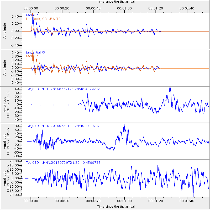
J05D Fort Rock, OR, USA - Earthquake Result Viewer
*The percent match for this event was below the threshold and hence no stack was calculated.
| Earthquake location: |
Mariana Islands |
| Earthquake latitude/longitude: |
18.5/145.5 |
| Earthquake time(UTC): |
2016/07/29 (211) 21:18:25 GMT |
| Earthquake Depth: |
212 km |
| Earthquake Magnitude: |
7.7 MWW, 7.7 MWB, 7.7 MI |
| Earthquake Catalog/Contributor: |
NEIC PDE/NEIC COMCAT |
|
| Network: |
TA USArray Transportable Network (new EarthScope stations) |
| Station: |
J05D Fort Rock, OR, USA |
| Lat/Lon: |
43.28 N/121.23 W |
| Elevation: |
1541 m |
|
| Distance: |
79.8 deg |
| Az: |
47.793 deg |
| Baz: |
285.745 deg |
| Ray Param: |
$rayparam |
*The percent match for this event was below the threshold and hence was not used in the summary stack. |
|
| Radial Match: |
94.47637 % |
| Radial Bump: |
400 |
| Transverse Match: |
87.11798 % |
| Transverse Bump: |
400 |
| SOD ConfigId: |
11737051 |
| Insert Time: |
2019-04-25 05:01:56.988 +0000 |
| GWidth: |
2.5 |
| Max Bumps: |
400 |
| Tol: |
0.001 |
|
Signal To Noise
| Channel | StoN | STA | LTA |
| TA:J05D: :HHZ:20160729T21:29:40.459973Z | 62.5757 | 1.4366822E-5 | 2.2959108E-7 |
| TA:J05D: :HHN:20160729T21:29:40.459973Z | 5.9444933 | 1.2981227E-6 | 2.1837397E-7 |
| TA:J05D: :HHE:20160729T21:29:40.459973Z | 16.687563 | 4.406454E-6 | 2.6405618E-7 |
| Arrivals |
| Ps | |
| PpPs | |
| PsPs/PpSs | |


