You are here: Home > Network List > UW - Pacific Northwest Regional Seismic Network Stations List
> Station LEBA Lebam, WA, USA > Earthquake Result Viewer
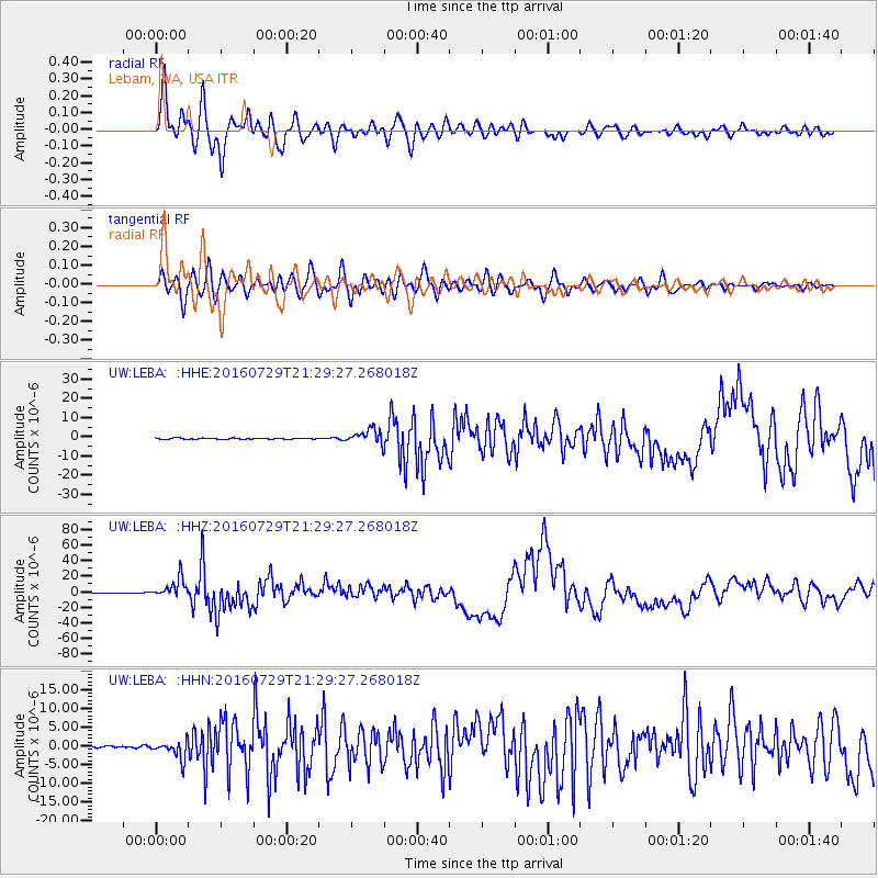
LEBA Lebam, WA, USA - Earthquake Result Viewer
*The percent match for this event was below the threshold and hence no stack was calculated.
| Earthquake location: |
Mariana Islands |
| Earthquake latitude/longitude: |
18.5/145.5 |
| Earthquake time(UTC): |
2016/07/29 (211) 21:18:25 GMT |
| Earthquake Depth: |
212 km |
| Earthquake Magnitude: |
7.7 MWW, 7.7 MWB, 7.7 MI |
| Earthquake Catalog/Contributor: |
NEIC PDE/NEIC COMCAT |
|
| Network: |
UW Pacific Northwest Regional Seismic Network |
| Station: |
LEBA Lebam, WA, USA |
| Lat/Lon: |
46.55 N/123.56 W |
| Elevation: |
73 m |
|
| Distance: |
77.4 deg |
| Az: |
45.002 deg |
| Baz: |
283.555 deg |
| Ray Param: |
$rayparam |
*The percent match for this event was below the threshold and hence was not used in the summary stack. |
|
| Radial Match: |
93.52935 % |
| Radial Bump: |
400 |
| Transverse Match: |
82.331825 % |
| Transverse Bump: |
400 |
| SOD ConfigId: |
11737051 |
| Insert Time: |
2019-04-25 05:03:35.690 +0000 |
| GWidth: |
2.5 |
| Max Bumps: |
400 |
| Tol: |
0.001 |
|
Signal To Noise
| Channel | StoN | STA | LTA |
| UW:LEBA: :HHZ:20160729T21:29:27.268018Z | 64.516815 | 1.2204069E-5 | 1.8916107E-7 |
| UW:LEBA: :HHN:20160729T21:29:27.268018Z | 6.7029786 | 2.348965E-6 | 3.5043598E-7 |
| UW:LEBA: :HHE:20160729T21:29:27.268018Z | 12.027811 | 3.2078394E-6 | 2.6670185E-7 |
| Arrivals |
| Ps | |
| PpPs | |
| PsPs/PpSs | |


