You are here: Home > Network List > TA - USArray Transportable Network (new EarthScope stations) Stations List
> Station F26K Sheenjek River, AK, USA > Earthquake Result Viewer
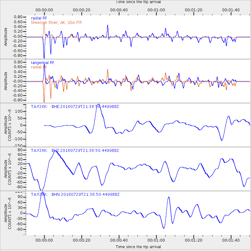
F26K Sheenjek River, AK, USA - Earthquake Result Viewer
*The percent match for this event was below the threshold and hence no stack was calculated.
| Earthquake location: |
Mariana Islands |
| Earthquake latitude/longitude: |
18.8/145.5 |
| Earthquake time(UTC): |
2016/07/29 (211) 21:26:59 GMT |
| Earthquake Depth: |
188 km |
| Earthquake Magnitude: |
5.6 mb |
| Earthquake Catalog/Contributor: |
NEIC PDE/us |
|
| Network: |
TA USArray Transportable Network (new EarthScope stations) |
| Station: |
F26K Sheenjek River, AK, USA |
| Lat/Lon: |
67.69 N/144.15 W |
| Elevation: |
683 m |
|
| Distance: |
65.4 deg |
| Az: |
23.301 deg |
| Baz: |
259.075 deg |
| Ray Param: |
$rayparam |
*The percent match for this event was below the threshold and hence was not used in the summary stack. |
|
| Radial Match: |
67.69973 % |
| Radial Bump: |
387 |
| Transverse Match: |
68.69822 % |
| Transverse Bump: |
400 |
| SOD ConfigId: |
11737051 |
| Insert Time: |
2019-04-25 05:10:27.649 +0000 |
| GWidth: |
2.5 |
| Max Bumps: |
400 |
| Tol: |
0.001 |
|
Signal To Noise
| Channel | StoN | STA | LTA |
| TA:F26K: :BHZ:20160729T21:36:50.449988Z | 3.8188255 | 5.3604814E-5 | 1.403699E-5 |
| TA:F26K: :BHN:20160729T21:36:50.449988Z | 16.556555 | 6.196032E-5 | 3.7423442E-6 |
| TA:F26K: :BHE:20160729T21:36:50.449988Z | 7.5573153 | 8.784062E-5 | 1.1623257E-5 |
| Arrivals |
| Ps | |
| PpPs | |
| PsPs/PpSs | |


