You are here: Home > Network List > US - United States National Seismic Network Stations List
> Station HAWA Hanford, Washington, USA > Earthquake Result Viewer
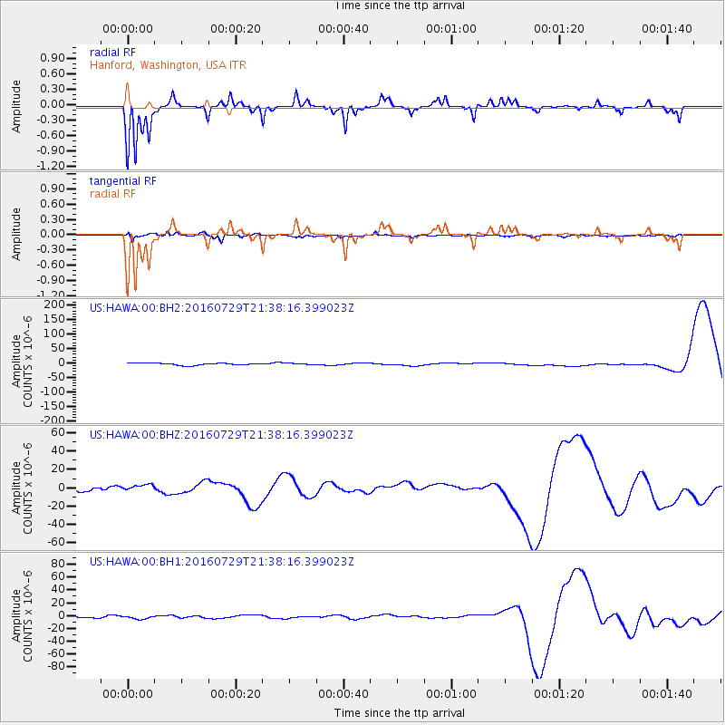
HAWA Hanford, Washington, USA - Earthquake Result Viewer
*The percent match for this event was below the threshold and hence no stack was calculated.
| Earthquake location: |
Mariana Islands |
| Earthquake latitude/longitude: |
18.8/145.5 |
| Earthquake time(UTC): |
2016/07/29 (211) 21:26:59 GMT |
| Earthquake Depth: |
188 km |
| Earthquake Magnitude: |
5.6 mb |
| Earthquake Catalog/Contributor: |
NEIC PDE/us |
|
| Network: |
US United States National Seismic Network |
| Station: |
HAWA Hanford, Washington, USA |
| Lat/Lon: |
46.39 N/119.53 W |
| Elevation: |
364 m |
|
| Distance: |
80.0 deg |
| Az: |
44.441 deg |
| Baz: |
286.554 deg |
| Ray Param: |
$rayparam |
*The percent match for this event was below the threshold and hence was not used in the summary stack. |
|
| Radial Match: |
74.63516 % |
| Radial Bump: |
237 |
| Transverse Match: |
42.75834 % |
| Transverse Bump: |
308 |
| SOD ConfigId: |
11737051 |
| Insert Time: |
2019-04-25 05:11:14.176 +0000 |
| GWidth: |
2.5 |
| Max Bumps: |
400 |
| Tol: |
0.001 |
|
Signal To Noise
| Channel | StoN | STA | LTA |
| US:HAWA:00:BHZ:20160729T21:38:16.399023Z | 1.0798433 | 3.9868123E-6 | 3.6920285E-6 |
| US:HAWA:00:BH1:20160729T21:38:16.399023Z | 1.5392963 | 2.4995088E-6 | 1.6237997E-6 |
| US:HAWA:00:BH2:20160729T21:38:16.399023Z | 0.709295 | 2.547151E-6 | 3.5911028E-6 |
| Arrivals |
| Ps | |
| PpPs | |
| PsPs/PpSs | |


