You are here: Home > Network List > CN - Canadian National Seismograph Network Stations List
> Station INK INUVIK, NT > Earthquake Result Viewer
INK INUVIK, NT - Earthquake Result Viewer
*The percent match for this event was below the threshold and hence no stack was calculated.
| Earthquake location: |
Solomon Islands |
| Earthquake latitude/longitude: |
-6.9/155.8 |
| Earthquake time(UTC): |
2016/07/30 (212) 13:19:10 GMT |
| Earthquake Depth: |
55 km |
| Earthquake Magnitude: |
5.7 MB |
| Earthquake Catalog/Contributor: |
NEIC PDE/NEIC ALERT |
|
| Network: |
CN Canadian National Seismograph Network |
| Station: |
INK INUVIK, NT |
| Lat/Lon: |
68.31 N/133.53 W |
| Elevation: |
44 m |
|
| Distance: |
89.4 deg |
| Az: |
20.541 deg |
| Baz: |
249.537 deg |
| Ray Param: |
$rayparam |
*The percent match for this event was below the threshold and hence was not used in the summary stack. |
|
| Radial Match: |
53.844982 % |
| Radial Bump: |
400 |
| Transverse Match: |
50.711445 % |
| Transverse Bump: |
400 |
| SOD ConfigId: |
11737051 |
| Insert Time: |
2019-04-25 05:14:48.006 +0000 |
| GWidth: |
2.5 |
| Max Bumps: |
400 |
| Tol: |
0.001 |
|
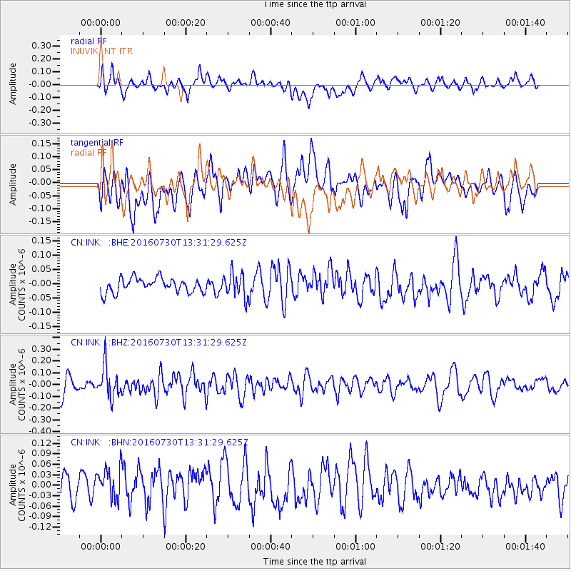
Signal To Noise
| Channel | StoN | STA | LTA |
| CN:INK: :BHZ:20160730T13:31:29.625Z | 1.6634601 | 1.3413427E-7 | 8.0635694E-8 |
| CN:INK: :BHN:20160730T13:31:29.625Z | 1.2164572 | 4.6344553E-8 | 3.809797E-8 |
| CN:INK: :BHE:20160730T13:31:29.625Z | 1.7056022 | 4.2605635E-8 | 2.4979819E-8 |
| Arrivals |
| Ps | |
| PpPs | |
| PsPs/PpSs | |


