You are here: Home > Network List > IU - Global Seismograph Network (GSN - IRIS/USGS) Stations List
> Station XMAS Kiritimati Island, Republic of Kiribati > Earthquake Result Viewer
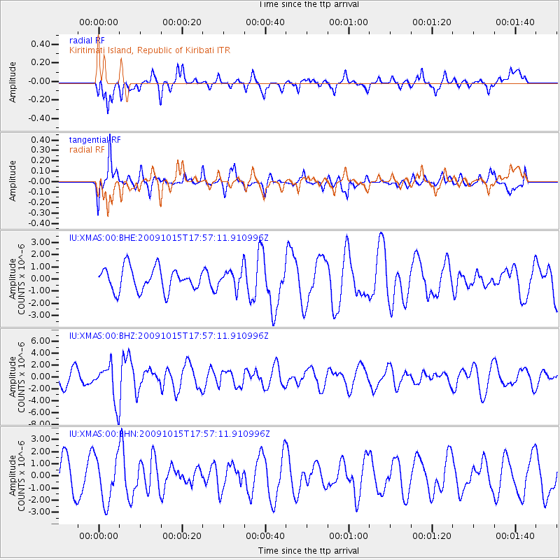
XMAS Kiritimati Island, Republic of Kiribati - Earthquake Result Viewer
*The percent match for this event was below the threshold and hence no stack was calculated.
| Earthquake location: |
Galapagos Triple Junction Region |
| Earthquake latitude/longitude: |
3.3/-103.8 |
| Earthquake time(UTC): |
2009/10/15 (288) 17:48:21 GMT |
| Earthquake Depth: |
10 km |
| Earthquake Magnitude: |
5.9 MB, 5.7 MS, 6.0 MW, 6.0 MW |
| Earthquake Catalog/Contributor: |
WHDF/NEIC |
|
| Network: |
IU Global Seismograph Network (GSN - IRIS/USGS) |
| Station: |
XMAS Kiritimati Island, Republic of Kiribati |
| Lat/Lon: |
2.04 N/157.45 W |
| Elevation: |
20 m |
|
| Distance: |
53.6 deg |
| Az: |
270.127 deg |
| Baz: |
87.459 deg |
| Ray Param: |
$rayparam |
*The percent match for this event was below the threshold and hence was not used in the summary stack. |
|
| Radial Match: |
45.526157 % |
| Radial Bump: |
400 |
| Transverse Match: |
50.263535 % |
| Transverse Bump: |
372 |
| SOD ConfigId: |
1 |
| Insert Time: |
2010-02-19 00:48:13.689 +0000 |
| GWidth: |
2.5 |
| Max Bumps: |
400 |
| Tol: |
0.001 |
|
Signal To Noise
| Channel | StoN | STA | LTA |
| IU:XMAS:00:BHZ:20091015T17:57:11.910996Z | 2.837123 | 3.2826927E-6 | 1.1570497E-6 |
| IU:XMAS:00:BHN:20091015T17:57:11.910996Z | 1.4266948 | 1.8569586E-6 | 1.3015809E-6 |
| IU:XMAS:00:BHE:20091015T17:57:11.910996Z | 0.84688956 | 7.963277E-7 | 9.40297E-7 |
| Arrivals |
| Ps | |
| PpPs | |
| PsPs/PpSs | |


