You are here: Home > Network List > TA - USArray Transportable Network (new EarthScope stations) Stations List
> Station R17K Ugashik Creek, AK, USA > Earthquake Result Viewer
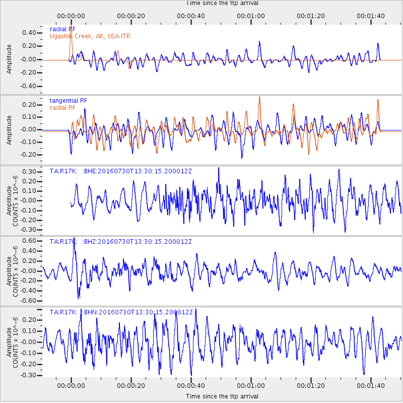
R17K Ugashik Creek, AK, USA - Earthquake Result Viewer
*The percent match for this event was below the threshold and hence no stack was calculated.
| Earthquake location: |
Solomon Islands |
| Earthquake latitude/longitude: |
-6.9/155.8 |
| Earthquake time(UTC): |
2016/07/30 (212) 13:19:10 GMT |
| Earthquake Depth: |
55 km |
| Earthquake Magnitude: |
5.7 MB |
| Earthquake Catalog/Contributor: |
NEIC PDE/NEIC ALERT |
|
| Network: |
TA USArray Transportable Network (new EarthScope stations) |
| Station: |
R17K Ugashik Creek, AK, USA |
| Lat/Lon: |
57.64 N/156.39 W |
| Elevation: |
273 m |
|
| Distance: |
75.1 deg |
| Az: |
24.355 deg |
| Baz: |
229.575 deg |
| Ray Param: |
$rayparam |
*The percent match for this event was below the threshold and hence was not used in the summary stack. |
|
| Radial Match: |
58.427143 % |
| Radial Bump: |
400 |
| Transverse Match: |
55.646168 % |
| Transverse Bump: |
400 |
| SOD ConfigId: |
11737051 |
| Insert Time: |
2019-04-25 05:17:26.144 +0000 |
| GWidth: |
2.5 |
| Max Bumps: |
400 |
| Tol: |
0.001 |
|
Signal To Noise
| Channel | StoN | STA | LTA |
| TA:R17K: :BHZ:20160730T13:30:15.200012Z | 2.5401173 | 2.973292E-7 | 1.1705333E-7 |
| TA:R17K: :BHN:20160730T13:30:15.200012Z | 1.3004587 | 1.2180476E-7 | 9.3662926E-8 |
| TA:R17K: :BHE:20160730T13:30:15.200012Z | 0.8737658 | 8.3108795E-8 | 9.511564E-8 |
| Arrivals |
| Ps | |
| PpPs | |
| PsPs/PpSs | |


