You are here: Home > Network List > US - United States National Seismic Network Stations List
> Station HAWA Hanford, Washington, USA > Earthquake Result Viewer
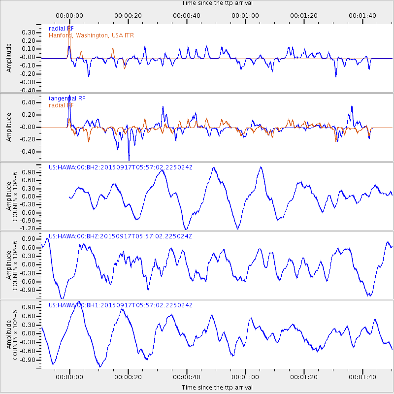
HAWA Hanford, Washington, USA - Earthquake Result Viewer
*The percent match for this event was below the threshold and hence no stack was calculated.
| Earthquake location: |
Off Coast Of Central Chile |
| Earthquake latitude/longitude: |
-31.8/-72.2 |
| Earthquake time(UTC): |
2015/09/17 (260) 05:44:39 GMT |
| Earthquake Depth: |
10 km |
| Earthquake Magnitude: |
5.5 MO |
| Earthquake Catalog/Contributor: |
NEIC PDE/NEIC ALERT |
|
| Network: |
US United States National Seismic Network |
| Station: |
HAWA Hanford, Washington, USA |
| Lat/Lon: |
46.39 N/119.53 W |
| Elevation: |
364 m |
|
| Distance: |
88.8 deg |
| Az: |
329.385 deg |
| Baz: |
141.214 deg |
| Ray Param: |
$rayparam |
*The percent match for this event was below the threshold and hence was not used in the summary stack. |
|
| Radial Match: |
55.659245 % |
| Radial Bump: |
400 |
| Transverse Match: |
68.75781 % |
| Transverse Bump: |
328 |
| SOD ConfigId: |
1156111 |
| Insert Time: |
2015-10-01 06:22:13.299 +0000 |
| GWidth: |
2.5 |
| Max Bumps: |
400 |
| Tol: |
0.001 |
|
Signal To Noise
| Channel | StoN | STA | LTA |
| US:HAWA:00:BHZ:20150917T05:57:02.225024Z | 0.84553593 | 5.17485E-7 | 6.120201E-7 |
| US:HAWA:00:BH1:20150917T05:57:02.225024Z | 1.7109935 | 8.806272E-7 | 5.1468766E-7 |
| US:HAWA:00:BH2:20150917T05:57:02.225024Z | 2.182497 | 7.8344766E-7 | 3.589685E-7 |
| Arrivals |
| Ps | |
| PpPs | |
| PsPs/PpSs | |


