You are here: Home > Network List > US - United States National Seismic Network Stations List
> Station MVCO Mesa Verde, Colorado, USA > Earthquake Result Viewer
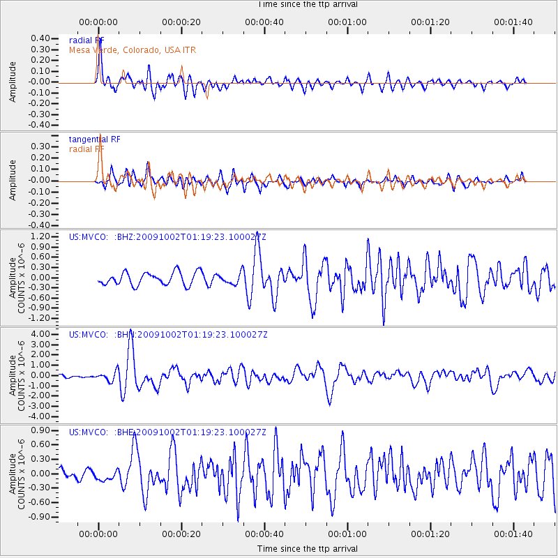
MVCO Mesa Verde, Colorado, USA - Earthquake Result Viewer
*The percent match for this event was below the threshold and hence no stack was calculated.
| Earthquake location: |
Tonga Islands |
| Earthquake latitude/longitude: |
-16.3/-173.5 |
| Earthquake time(UTC): |
2009/10/02 (275) 01:07:39 GMT |
| Earthquake Depth: |
8.0 km |
| Earthquake Magnitude: |
6.1 MB, 6.0 MS, 6.1 MW, 6.1 MW |
| Earthquake Catalog/Contributor: |
WHDF/NEIC |
|
| Network: |
US United States National Seismic Network |
| Station: |
MVCO Mesa Verde, Colorado, USA |
| Lat/Lon: |
37.21 N/108.50 W |
| Elevation: |
2170 m |
|
| Distance: |
81.0 deg |
| Az: |
47.086 deg |
| Baz: |
241.735 deg |
| Ray Param: |
$rayparam |
*The percent match for this event was below the threshold and hence was not used in the summary stack. |
|
| Radial Match: |
75.46458 % |
| Radial Bump: |
400 |
| Transverse Match: |
71.30221 % |
| Transverse Bump: |
400 |
| SOD ConfigId: |
2622 |
| Insert Time: |
2010-03-05 05:54:33.534 +0000 |
| GWidth: |
2.5 |
| Max Bumps: |
400 |
| Tol: |
0.001 |
|
Signal To Noise
| Channel | StoN | STA | LTA |
| US:MVCO: :BHN:20091002T01:19:23.100027Z | 3.1879895 | 4.706999E-7 | 1.4764788E-7 |
| US:MVCO: :BHE:20091002T01:19:23.100027Z | 0.7883088 | 9.158112E-8 | 1.1617418E-7 |
| US:MVCO: :BHZ:20091002T01:19:23.100027Z | 0.87624353 | 1.6403955E-7 | 1.8720772E-7 |
| Arrivals |
| Ps | |
| PpPs | |
| PsPs/PpSs | |


