COWI Conover, Wisconsin, USA - Earthquake Result Viewer
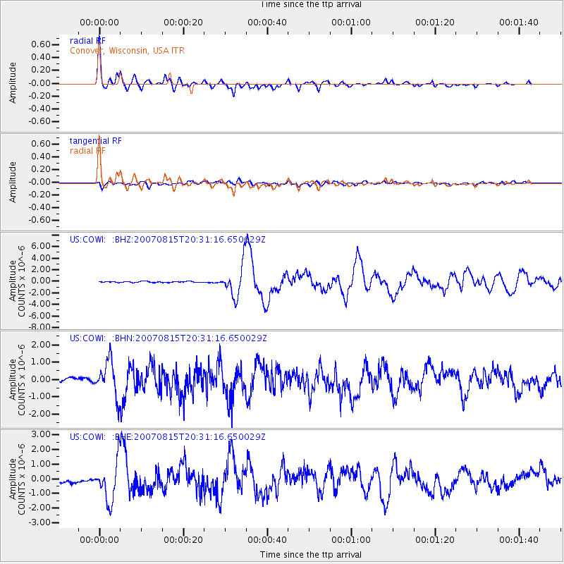
Earthquake location: Andreanof Islands, Aleutian Is.
Earthquake latitude/longitude: 50.3/-177.5
Earthquake time(UTC): 2007/08/15 (227) 20:22:11 GMT
Earthquake Depth: 9.0 km
Earthquake Magnitude: 6.3 MB, 6.2 MS, 6.4 MW, 5.9 ML
Earthquake Catalog/Contributor: WHDF/NEIC
Network: US United States National Seismic Network
Station: COWI Conover, Wisconsin, USA
Lat/Lon: 46.10 N/89.14 W
Elevation: 523 m
Distance: 55.7 deg
Az: 57.356 deg
Baz: 309.13 deg
Ray Param: 0.06462951
Estimated Moho Depth: 34.0 km
Estimated Crust Vp/Vs: 1.76
Assumed Crust Vp: 6.467 km/s
Estimated Crust Vs: 3.669 km/s
Estimated Crust Poisson's Ratio: 0.26
Radial Match: 93.39049 %
Radial Bump: 400
Transverse Match: 80.47639 %
Transverse Bump: 400
SOD ConfigId: 2564
Insert Time: 2010-03-05 05:55:23.001 +0000
GWidth: 2.5
Max Bumps: 400
Tol: 0.001

Signal To Noise

ChannelStoNSTALTA
US:COWI: :BHN:20070815T20:31:16.650029Z9.5873971.0530458E-61.0983647E-7
US:COWI: :BHE:20070815T20:31:16.650029Z10.7850011.4018243E-61.2997907E-7
US:COWI: :BHZ:20070815T20:31:16.650029Z32.3651162.8772033E-68.889828E-8
Arrivals
Ps4.2 SECOND
PpPs14 SECOND
PsPs/PpSs18 SECOND