COWI Conover, Wisconsin, USA - Earthquake Result Viewer
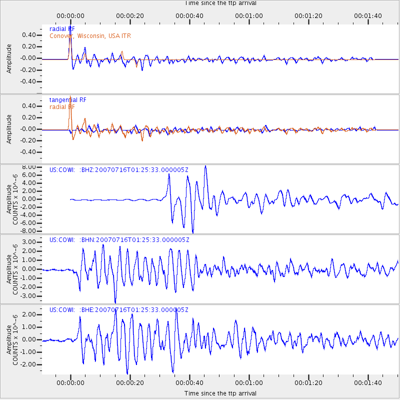
Earthquake location: Near West Coast Of Honshu, Japan
Earthquake latitude/longitude: 37.5/138.4
Earthquake time(UTC): 2007/07/16 (197) 01:13:22 GMT
Earthquake Depth: 12 km
Earthquake Magnitude: 6.5 MB, 6.4 MS, 6.6 MW, 6.5 MW
Earthquake Catalog/Contributor: WHDF/NEIC
Network: US United States National Seismic Network
Station: COWI Conover, Wisconsin, USA
Lat/Lon: 46.10 N/89.14 W
Elevation: 523 m
Distance: 86.4 deg
Az: 30.977 deg
Baz: 323.983 deg
Ray Param: 0.044068735
Estimated Moho Depth: 32.25 km
Estimated Crust Vp/Vs: 1.88
Assumed Crust Vp: 6.467 km/s
Estimated Crust Vs: 3.44 km/s
Estimated Crust Poisson's Ratio: 0.30
Radial Match: 96.92989 %
Radial Bump: 400
Transverse Match: 93.07214 %
Transverse Bump: 400
SOD ConfigId: 2564
Insert Time: 2010-03-05 05:55:32.176 +0000
GWidth: 2.5
Max Bumps: 400
Tol: 0.001

Signal To Noise

ChannelStoNSTALTA
US:COWI: :BHN:20070716T01:25:33.000005Z11.0513761.0012756E-69.060188E-8
US:COWI: :BHE:20070716T01:25:33.000005Z11.3446888.1022023E-77.141846E-8
US:COWI: :BHZ:20070716T01:25:33.000005Z27.8367962.7402505E-69.843986E-8
Arrivals
Ps4.5 SECOND
PpPs14 SECOND
PsPs/PpSs19 SECOND