You are here: Home > Network List > UW - Pacific Northwest Regional Seismic Network Stations List
> Station LEBA Lebam, WA, USA > Earthquake Result Viewer
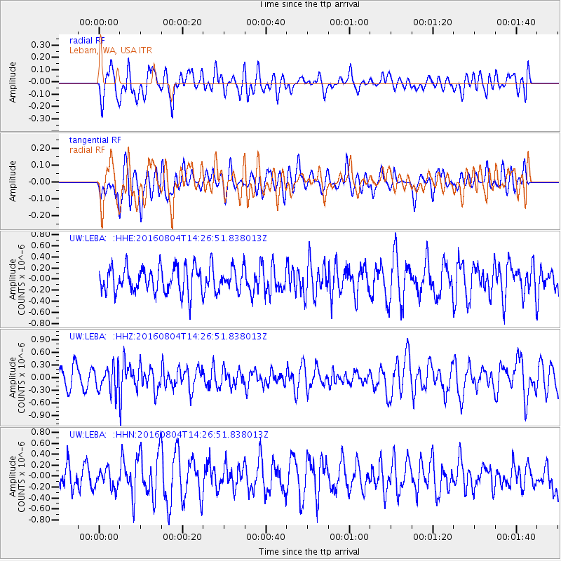
LEBA Lebam, WA, USA - Earthquake Result Viewer
*The percent match for this event was below the threshold and hence no stack was calculated.
| Earthquake location: |
Jujuy Province, Argentina |
| Earthquake latitude/longitude: |
-22.4/-66.0 |
| Earthquake time(UTC): |
2016/08/04 (217) 14:15:11 GMT |
| Earthquake Depth: |
258 km |
| Earthquake Magnitude: |
6.0 MO |
| Earthquake Catalog/Contributor: |
NEIC PDE/NEIC ALERT |
|
| Network: |
UW Pacific Northwest Regional Seismic Network |
| Station: |
LEBA Lebam, WA, USA |
| Lat/Lon: |
46.55 N/123.56 W |
| Elevation: |
73 m |
|
| Distance: |
86.1 deg |
| Az: |
324.272 deg |
| Baz: |
128.461 deg |
| Ray Param: |
$rayparam |
*The percent match for this event was below the threshold and hence was not used in the summary stack. |
|
| Radial Match: |
49.59229 % |
| Radial Bump: |
400 |
| Transverse Match: |
34.155666 % |
| Transverse Bump: |
400 |
| SOD ConfigId: |
11737051 |
| Insert Time: |
2019-04-25 05:44:06.041 +0000 |
| GWidth: |
2.5 |
| Max Bumps: |
400 |
| Tol: |
0.001 |
|
Signal To Noise
| Channel | StoN | STA | LTA |
| UW:LEBA: :HHZ:20160804T14:26:51.838013Z | 1.5262175 | 3.115326E-7 | 2.0412071E-7 |
| UW:LEBA: :HHN:20160804T14:26:51.838013Z | 0.7567396 | 1.7479846E-7 | 2.3098892E-7 |
| UW:LEBA: :HHE:20160804T14:26:51.838013Z | 0.7368886 | 1.6937426E-7 | 2.2985056E-7 |
| Arrivals |
| Ps | |
| PpPs | |
| PsPs/PpSs | |


