
AMKA Regional Station, Amchitka Island, Alaska - Earthquake Result Viewer
| ||||||||||||||||||
| ||||||||||||||||||
| ||||||||||||||||||
|
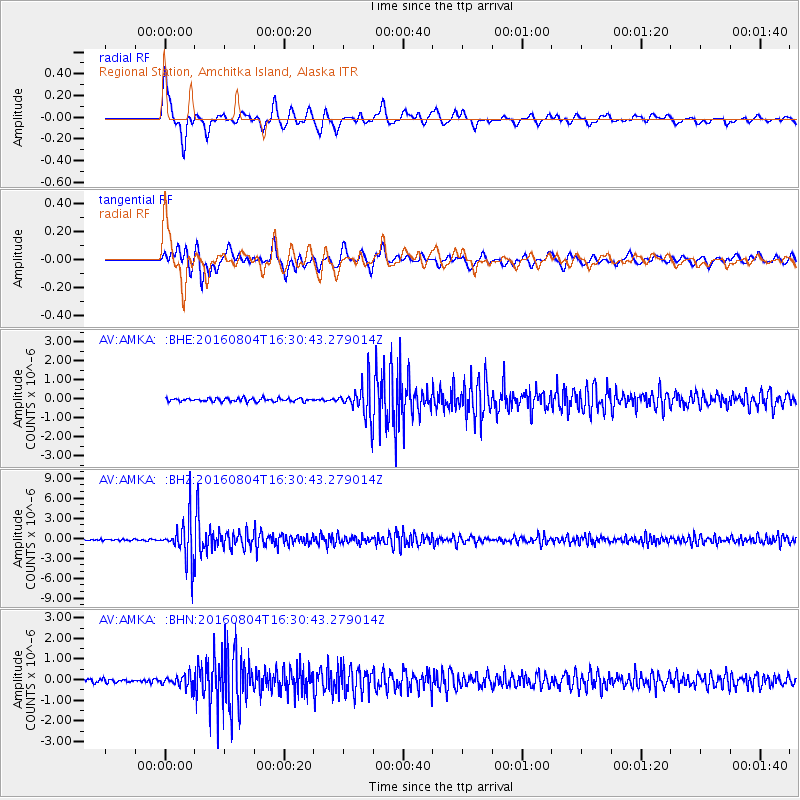
Signal To Noise
| Channel | StoN | STA | LTA |
| AV:AMKA: :BHZ:20160804T16:30:43.279014Z | 32.755245 | 3.0449125E-6 | 9.2959546E-8 |
| AV:AMKA: :BHN:20160804T16:30:43.279014Z | 3.3339796 | 2.6970858E-7 | 8.0896896E-8 |
| AV:AMKA: :BHE:20160804T16:30:43.279014Z | 10.457033 | 8.952914E-7 | 8.561619E-8 |
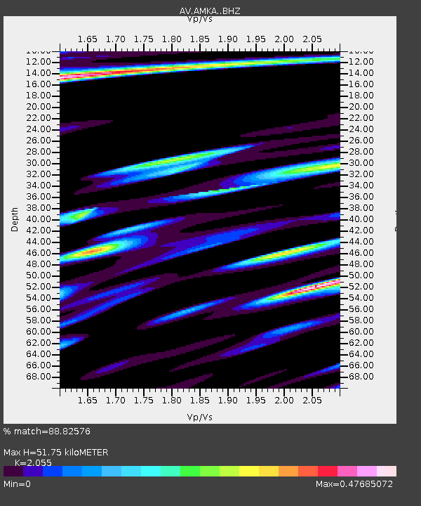
| Arrivals | |
| Ps | 9.3 SECOND |
| PpPs | 24 SECOND |
| PsPs/PpSs | 34 SECOND |

