You are here: Home > Network List > CI - Caltech Regional Seismic Network Stations List
> Station LRL Laurel Mtn Radio Fac, Ridgecrest, CA, USA > Earthquake Result Viewer
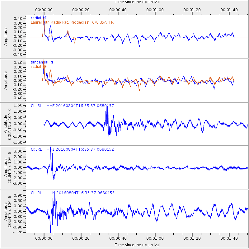
LRL Laurel Mtn Radio Fac, Ridgecrest, CA, USA - Earthquake Result Viewer
*The percent match for this event was below the threshold and hence no stack was calculated.
| Earthquake location: |
Volcano Islands, Japan Region |
| Earthquake latitude/longitude: |
24.9/142.0 |
| Earthquake time(UTC): |
2016/08/04 (217) 16:24:33 GMT |
| Earthquake Depth: |
510 km |
| Earthquake Magnitude: |
6.3 MWW, 6.2 MWC, 6.3 MWB, 6.3 MWC |
| Earthquake Catalog/Contributor: |
NEIC PDE/NEIC COMCAT |
|
| Network: |
CI Caltech Regional Seismic Network |
| Station: |
LRL Laurel Mtn Radio Fac, Ridgecrest, CA, USA |
| Lat/Lon: |
35.48 N/117.68 W |
| Elevation: |
1340 m |
|
| Distance: |
83.7 deg |
| Az: |
53.888 deg |
| Baz: |
296.033 deg |
| Ray Param: |
$rayparam |
*The percent match for this event was below the threshold and hence was not used in the summary stack. |
|
| Radial Match: |
74.48231 % |
| Radial Bump: |
400 |
| Transverse Match: |
66.62262 % |
| Transverse Bump: |
400 |
| SOD ConfigId: |
11737051 |
| Insert Time: |
2019-04-25 05:50:11.217 +0000 |
| GWidth: |
2.5 |
| Max Bumps: |
400 |
| Tol: |
0.001 |
|
Signal To Noise
| Channel | StoN | STA | LTA |
| CI:LRL: :HHZ:20160804T16:35:37.068015Z | 7.7272987 | 1.0964017E-6 | 1.418868E-7 |
| CI:LRL: :HHN:20160804T16:35:37.068015Z | 2.61736 | 3.633415E-7 | 1.3881983E-7 |
| CI:LRL: :HHE:20160804T16:35:37.068015Z | 3.334822 | 4.7510733E-7 | 1.4246856E-7 |
| Arrivals |
| Ps | |
| PpPs | |
| PsPs/PpSs | |


