You are here: Home > Network List > CI - Caltech Regional Seismic Network Stations List
> Station SMM Simmler, CA, USA > Earthquake Result Viewer
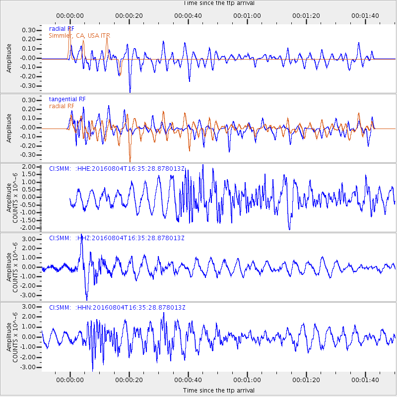
SMM Simmler, CA, USA - Earthquake Result Viewer
*The percent match for this event was below the threshold and hence no stack was calculated.
| Earthquake location: |
Volcano Islands, Japan Region |
| Earthquake latitude/longitude: |
24.9/142.0 |
| Earthquake time(UTC): |
2016/08/04 (217) 16:24:33 GMT |
| Earthquake Depth: |
510 km |
| Earthquake Magnitude: |
6.3 MWW, 6.2 MWC, 6.3 MWB, 6.3 MWC |
| Earthquake Catalog/Contributor: |
NEIC PDE/NEIC COMCAT |
|
| Network: |
CI Caltech Regional Seismic Network |
| Station: |
SMM Simmler, CA, USA |
| Lat/Lon: |
35.31 N/120.00 W |
| Elevation: |
599 m |
|
| Distance: |
82.1 deg |
| Az: |
54.856 deg |
| Baz: |
294.818 deg |
| Ray Param: |
$rayparam |
*The percent match for this event was below the threshold and hence was not used in the summary stack. |
|
| Radial Match: |
48.65644 % |
| Radial Bump: |
400 |
| Transverse Match: |
55.189453 % |
| Transverse Bump: |
381 |
| SOD ConfigId: |
11737051 |
| Insert Time: |
2019-04-25 05:50:26.104 +0000 |
| GWidth: |
2.5 |
| Max Bumps: |
400 |
| Tol: |
0.001 |
|
Signal To Noise
| Channel | StoN | STA | LTA |
| CI:SMM: :HHZ:20160804T16:35:28.878013Z | 3.1313825 | 1.1074858E-6 | 3.5367313E-7 |
| CI:SMM: :HHN:20160804T16:35:28.878013Z | 0.9384109 | 4.0450374E-7 | 4.3105186E-7 |
| CI:SMM: :HHE:20160804T16:35:28.878013Z | 2.2281535 | 1.0407356E-6 | 4.6708433E-7 |
| Arrivals |
| Ps | |
| PpPs | |
| PsPs/PpSs | |


