LBNH Lisbon, New Hampshire, USA - Earthquake Result Viewer
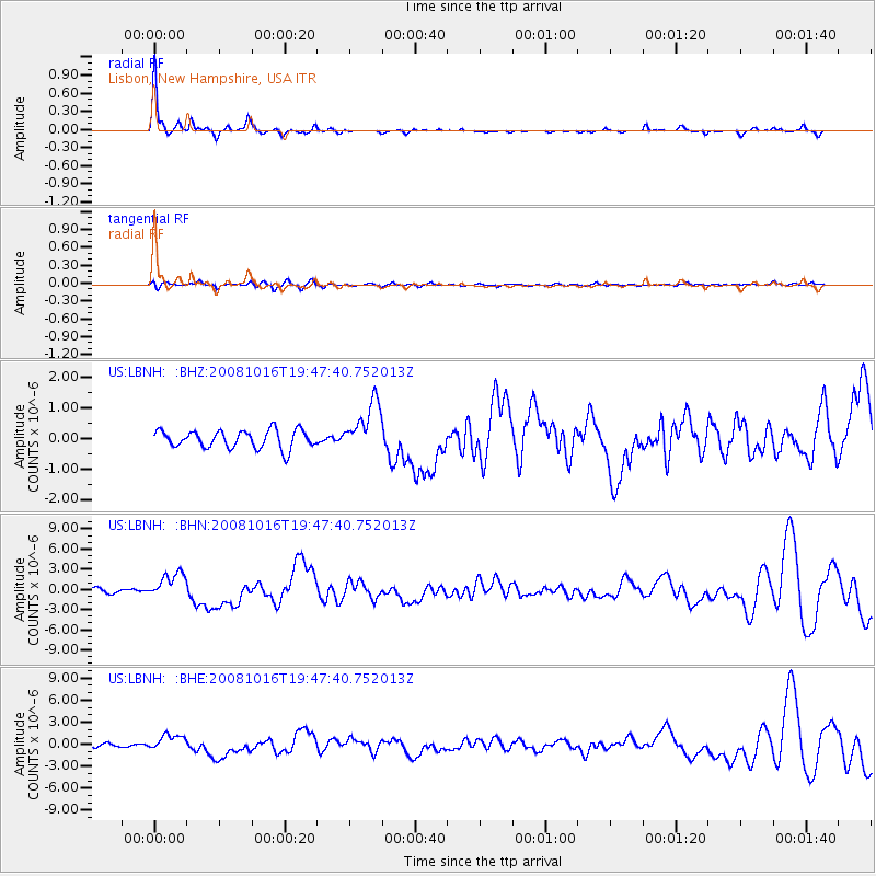
Earthquake location: Near Coast Of Chiapas, Mexico
Earthquake latitude/longitude: 14.4/-92.4
Earthquake time(UTC): 2008/10/16 (290) 19:41:25 GMT
Earthquake Depth: 24 km
Earthquake Magnitude: 6.1 MB, 6.6 MS, 6.7 MW, 6.6 MW
Earthquake Catalog/Contributor: WHDF/NEIC
Network: US United States National Seismic Network
Station: LBNH Lisbon, New Hampshire, USA
Lat/Lon: 44.24 N/71.93 W
Elevation: 367 m
Distance: 34.4 deg
Az: 26.341 deg
Baz: 216.736 deg
Ray Param: 0.07770212
Estimated Moho Depth: 32.25 km
Estimated Crust Vp/Vs: 2.06
Assumed Crust Vp: 6.419 km/s
Estimated Crust Vs: 3.124 km/s
Estimated Crust Poisson's Ratio: 0.34
Radial Match: 92.95795 %
Radial Bump: 201
Transverse Match: 66.89853 %
Transverse Bump: 400
SOD ConfigId: 2556
Insert Time: 2010-03-05 05:57:59.263 +0000
GWidth: 2.5
Max Bumps: 400
Tol: 0.001

Signal To Noise

ChannelStoNSTALTA
US:LBNH: :BHN:20081016T19:47:40.752013Z4.6569561.9292743E-64.1427796E-7
US:LBNH: :BHE:20081016T19:47:40.752013Z3.767961.075497E-62.8543215E-7
US:LBNH: :BHZ:20081016T19:47:40.752013Z2.82147038.208086E-72.909152E-7
Arrivals
Ps5.7 SECOND
PpPs14 SECOND
PsPs/PpSs20 SECOND