
G21K Allakaket, AK, USA - Earthquake Result Viewer
| ||||||||||||||||||
| ||||||||||||||||||
| ||||||||||||||||||
|
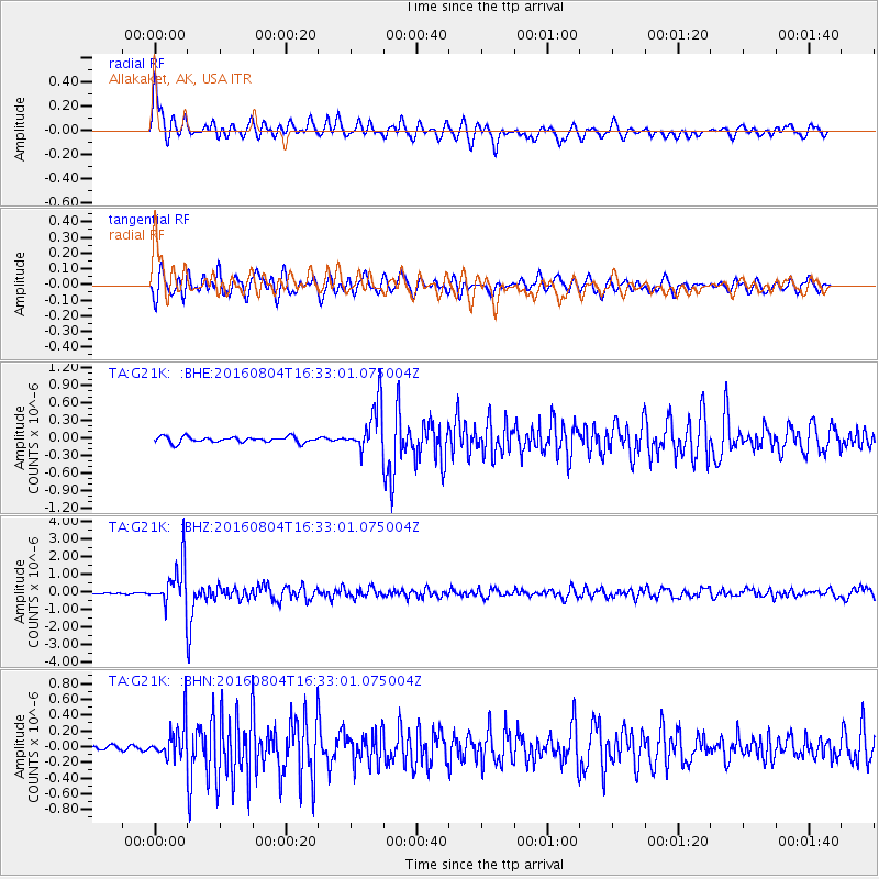
Signal To Noise
| Channel | StoN | STA | LTA |
| TA:G21K: :BHZ:20160804T16:33:01.075004Z | 23.31554 | 1.220201E-6 | 5.2334236E-8 |
| TA:G21K: :BHN:20160804T16:33:01.075004Z | 5.5255613 | 2.2425387E-7 | 4.0584812E-8 |
| TA:G21K: :BHE:20160804T16:33:01.075004Z | 8.242178 | 4.0613594E-7 | 4.9275318E-8 |
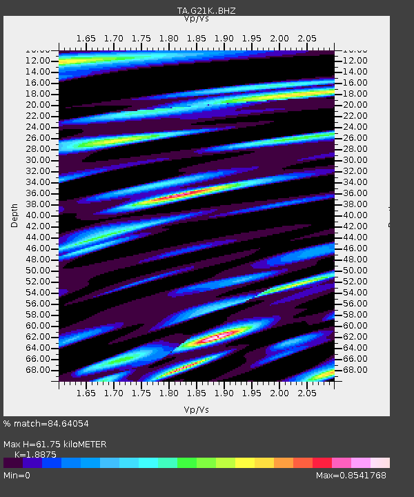
| Arrivals | |
| Ps | 8.9 SECOND |
| PpPs | 26 SECOND |
| PsPs/PpSs | 35 SECOND |

