
G23K Bananza Creek, AK, USA - Earthquake Result Viewer
| ||||||||||||||||||
| ||||||||||||||||||
| ||||||||||||||||||
|
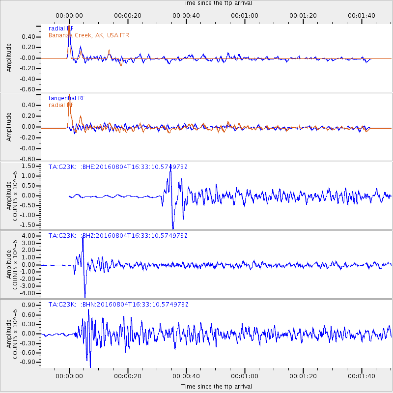
Signal To Noise
| Channel | StoN | STA | LTA |
| TA:G23K: :BHZ:20160804T16:33:10.574973Z | 37.302315 | 1.1444529E-6 | 3.0680482E-8 |
| TA:G23K: :BHN:20160804T16:33:10.574973Z | 4.150214 | 1.3079448E-7 | 3.1515114E-8 |
| TA:G23K: :BHE:20160804T16:33:10.574973Z | 11.99811 | 5.1510136E-7 | 4.2931877E-8 |
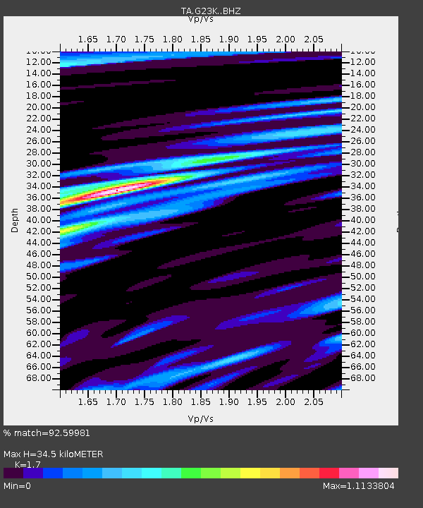
| Arrivals | |
| Ps | 3.9 SECOND |
| PpPs | 13 SECOND |
| PsPs/PpSs | 17 SECOND |

