H24K Noodor Dome, AK, USA - Earthquake Result Viewer
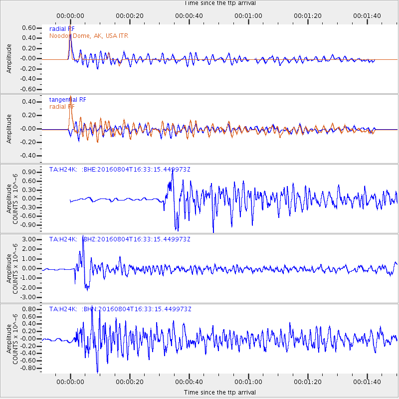
Earthquake location: Volcano Islands, Japan Region
Earthquake latitude/longitude: 24.9/142.0
Earthquake time(UTC): 2016/08/04 (217) 16:24:33 GMT
Earthquake Depth: 510 km
Earthquake Magnitude: 6.3 MWW, 6.2 MWC, 6.3 MWB, 6.3 MWC
Earthquake Catalog/Contributor: NEIC PDE/NEIC COMCAT
Network: TA USArray Transportable Network (new EarthScope stations)
Station: H24K Noodor Dome, AK, USA
Lat/Lon: 65.84 N/147.88 W
Elevation: 814 m
Distance: 59.4 deg
Az: 26.732 deg
Baz: 262.741 deg
Ray Param: 0.060251486
Estimated Moho Depth: 24.5 km
Estimated Crust Vp/Vs: 1.90
Assumed Crust Vp: 6.566 km/s
Estimated Crust Vs: 3.447 km/s
Estimated Crust Poisson's Ratio: 0.31
Radial Match: 85.18027 %
Radial Bump: 400
Transverse Match: 68.34235 %
Transverse Bump: 400
SOD ConfigId: 11737051
Insert Time: 2019-04-25 05:54:51.837 +0000
GWidth: 2.5
Max Bumps: 400
Tol: 0.001

Signal To Noise

ChannelStoNSTALTA
TA:H24K: :BHZ:20160804T16:33:15.449973Z19.1827831.0420343E-65.432133E-8
TA:H24K: :BHN:20160804T16:33:15.449973Z3.77377581.6055834E-74.2545807E-8
TA:H24K: :BHE:20160804T16:33:15.449973Z10.3111983.6856247E-73.5743906E-8
Arrivals
Ps3.5 SECOND
PpPs10 SECOND
PsPs/PpSs14 SECOND