J26L Joseph Creek, AK, USA - Earthquake Result Viewer
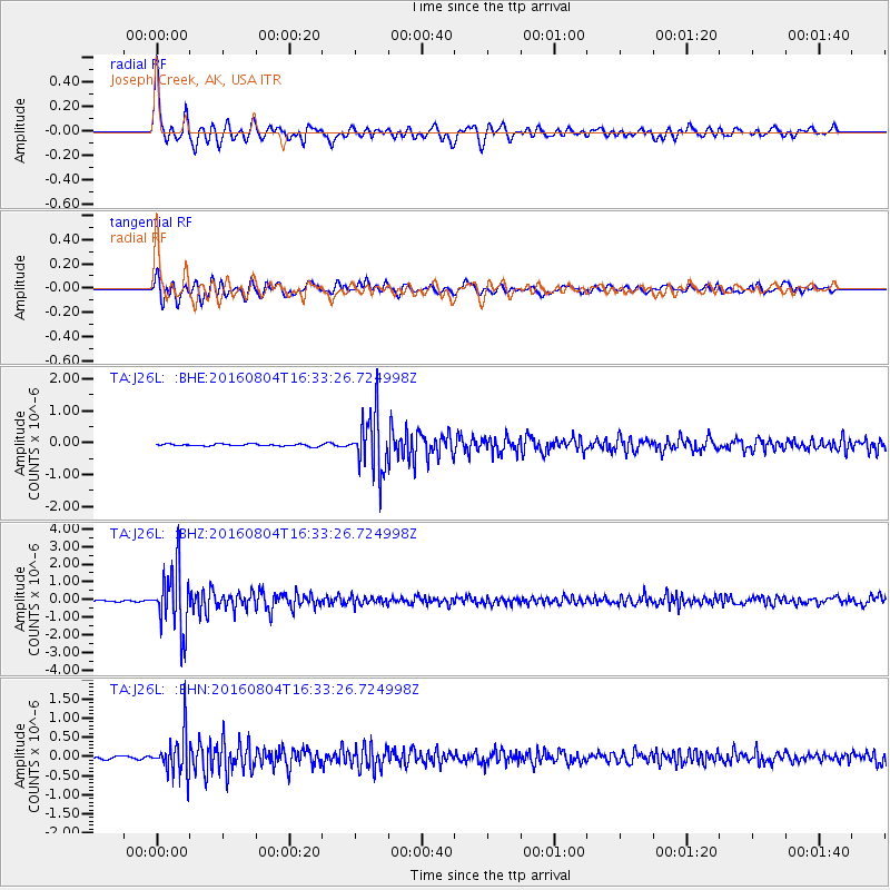
Earthquake location: Volcano Islands, Japan Region
Earthquake latitude/longitude: 24.9/142.0
Earthquake time(UTC): 2016/08/04 (217) 16:24:33 GMT
Earthquake Depth: 510 km
Earthquake Magnitude: 6.3 MWW, 6.2 MWC, 6.3 MWB, 6.3 MWC
Earthquake Catalog/Contributor: NEIC PDE/NEIC COMCAT
Network: TA USArray Transportable Network (new EarthScope stations)
Station: J26L Joseph Creek, AK, USA
Lat/Lon: 64.50 N/143.56 W
Elevation: 1144 m
Distance: 61.1 deg
Az: 28.449 deg
Baz: 267.505 deg
Ray Param: 0.059191648
Estimated Moho Depth: 47.25 km
Estimated Crust Vp/Vs: 1.60
Assumed Crust Vp: 6.566 km/s
Estimated Crust Vs: 4.104 km/s
Estimated Crust Poisson's Ratio: 0.18
Radial Match: 88.16394 %
Radial Bump: 400
Transverse Match: 81.42895 %
Transverse Bump: 400
SOD ConfigId: 11737051
Insert Time: 2019-04-25 05:55:06.325 +0000
GWidth: 2.5
Max Bumps: 400
Tol: 0.001

Signal To Noise

ChannelStoNSTALTA
TA:J26L: :BHZ:20160804T16:33:26.724998Z48.5066641.7339621E-63.5746883E-8
TA:J26L: :BHN:20160804T16:33:26.724998Z18.1035295.280566E-72.916871E-8
TA:J26L: :BHE:20160804T16:33:26.724998Z27.2160938.7419585E-73.212055E-8
Arrivals
Ps4.5 SECOND
PpPs18 SECOND
PsPs/PpSs22 SECOND