
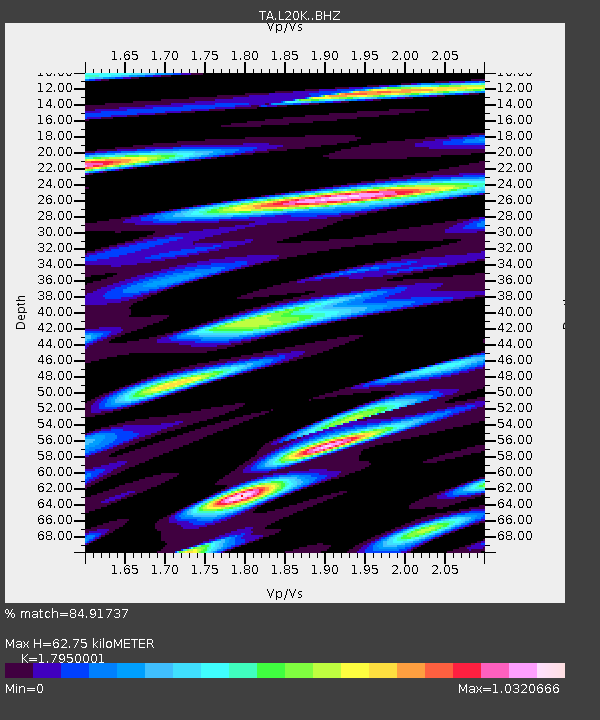
L20K Farewell, AK, USA - Earthquake Result Viewer
| ||||||||||||||||||
| ||||||||||||||||||
| ||||||||||||||||||
|
Signal To Noise
| Channel | StoN | STA | LTA |
| TA:L20K: :BHZ:20160804T16:32:54.224998Z | 19.261753 | 1.0746896E-6 | 5.579397E-8 |
| TA:L20K: :BHN:20160804T16:32:54.224998Z | 2.0258598 | 1.3057253E-7 | 6.44529E-8 |
| TA:L20K: :BHE:20160804T16:32:54.224998Z | 10.264314 | 5.8719075E-7 | 5.7207018E-8 |
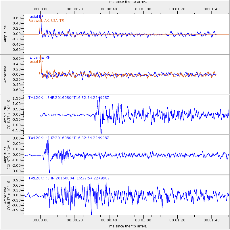
| Arrivals | |
| Ps | 8.0 SECOND |
| PpPs | 25 SECOND |
| PsPs/PpSs | 33 SECOND |

