P17K Kvichak River, AK, USA - Earthquake Result Viewer
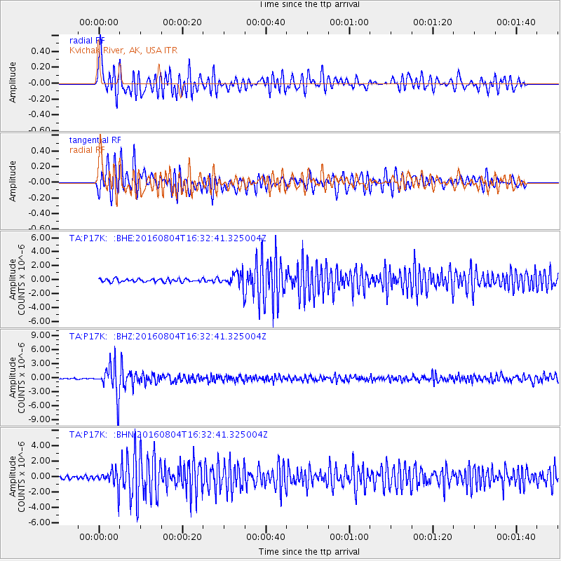
Earthquake location: Volcano Islands, Japan Region
Earthquake latitude/longitude: 24.9/142.0
Earthquake time(UTC): 2016/08/04 (217) 16:24:33 GMT
Earthquake Depth: 510 km
Earthquake Magnitude: 6.3 MWW, 6.2 MWC, 6.3 MWB, 6.3 MWC
Earthquake Catalog/Contributor: NEIC PDE/NEIC COMCAT
Network: TA USArray Transportable Network (new EarthScope stations)
Station: P17K Kvichak River, AK, USA
Lat/Lon: 59.20 N/156.44 W
Elevation: 91 m
Distance: 54.4 deg
Az: 33.818 deg
Baz: 259.019 deg
Ray Param: 0.063355334
Estimated Moho Depth: 29.0 km
Estimated Crust Vp/Vs: 2.06
Assumed Crust Vp: 6.276 km/s
Estimated Crust Vs: 3.047 km/s
Estimated Crust Poisson's Ratio: 0.35
Radial Match: 85.00792 %
Radial Bump: 400
Transverse Match: 85.33411 %
Transverse Bump: 400
SOD ConfigId: 11737051
Insert Time: 2019-04-25 05:55:41.049 +0000
GWidth: 2.5
Max Bumps: 400
Tol: 0.001

Signal To Noise

ChannelStoNSTALTA
TA:P17K: :BHZ:20160804T16:32:41.325004Z40.8357163.3649926E-68.2403176E-8
TA:P17K: :BHN:20160804T16:32:41.325004Z4.7590561.1559605E-62.4289702E-7
TA:P17K: :BHE:20160804T16:32:41.325004Z4.9055981.1087561E-62.2601854E-7
Arrivals
Ps5.1 SECOND
PpPs14 SECOND
PsPs/PpSs19 SECOND