You are here: Home > Network List > TA - USArray Transportable Network (new EarthScope stations) Stations List
> Station R33M Jennings River, BC, CAN > Earthquake Result Viewer
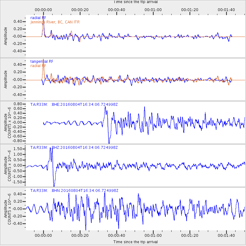
R33M Jennings River, BC, CAN - Earthquake Result Viewer
*The percent match for this event was below the threshold and hence no stack was calculated.
| Earthquake location: |
Volcano Islands, Japan Region |
| Earthquake latitude/longitude: |
24.9/142.0 |
| Earthquake time(UTC): |
2016/08/04 (217) 16:24:33 GMT |
| Earthquake Depth: |
510 km |
| Earthquake Magnitude: |
6.3 MWW, 6.2 MWC, 6.3 MWB, 6.3 MWC |
| Earthquake Catalog/Contributor: |
NEIC PDE/NEIC COMCAT |
|
| Network: |
TA USArray Transportable Network (new EarthScope stations) |
| Station: |
R33M Jennings River, BC, CAN |
| Lat/Lon: |
59.39 N/130.97 W |
| Elevation: |
1437 m |
|
| Distance: |
67.4 deg |
| Az: |
33.609 deg |
| Baz: |
280.874 deg |
| Ray Param: |
$rayparam |
*The percent match for this event was below the threshold and hence was not used in the summary stack. |
|
| Radial Match: |
79.404465 % |
| Radial Bump: |
400 |
| Transverse Match: |
72.862625 % |
| Transverse Bump: |
400 |
| SOD ConfigId: |
11737051 |
| Insert Time: |
2019-04-25 05:55:54.283 +0000 |
| GWidth: |
2.5 |
| Max Bumps: |
400 |
| Tol: |
0.001 |
|
Signal To Noise
| Channel | StoN | STA | LTA |
| TA:R33M: :BHZ:20160804T16:34:06.724998Z | 10.134086 | 6.7458177E-7 | 6.656563E-8 |
| TA:R33M: :BHN:20160804T16:34:06.724998Z | 1.8566401 | 1.304731E-7 | 7.027377E-8 |
| TA:R33M: :BHE:20160804T16:34:06.724998Z | 5.8382106 | 2.8496257E-7 | 4.8809916E-8 |
| Arrivals |
| Ps | |
| PpPs | |
| PsPs/PpSs | |


