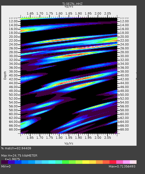
GEZN Gezan, Tajikistan - Earthquake Result Viewer
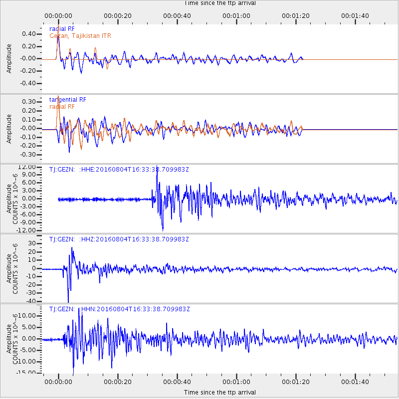
Earthquake location: Volcano Islands, Japan Region
Earthquake latitude/longitude: 24.9/142.0
Earthquake time(UTC): 2016/08/04 (217) 16:24:33 GMT
Earthquake Depth: 510 km
Earthquake Magnitude: 6.3 MWW, 6.2 MWC, 6.3 MWB, 6.3 MWC
Earthquake Catalog/Contributor: NEIC PDE/NEIC COMCAT
Network: TJ Tajikistan National Seismic Network
Station: GEZN Gezan, Tajikistan
Lat/Lon: 39.28 N/67.72 E
Elevation: 1485 m
Distance: 62.9 deg
Az: 302.953 deg
Baz: 78.956 deg
Ray Param: 0.058044035
Estimated Moho Depth: 24.75 km
Estimated Crust Vp/Vs: 1.99
Assumed Crust Vp: 6.444 km/s
Estimated Crust Vs: 3.242 km/s
Estimated Crust Poisson's Ratio: 0.33
Radial Match: 82.94409 %
Radial Bump: 400
Transverse Match: 76.65087 %
Transverse Bump: 400
SOD ConfigId: 11737051
Insert Time: 2019-04-25 05:56:09.863 +0000
GWidth: 2.5
Max Bumps: 400
Tol: 0.001

Signal To Noise

ChannelStoNSTALTA
TJ:GEZN: :HHZ:20160804T16:33:38.709983Z50.4121861.1818238E-52.3443218E-7
TJ:GEZN: :HHN:20160804T16:33:38.709983Z8.5059972.2539102E-62.6497898E-7
TJ:GEZN: :HHE:20160804T16:33:38.709983Z13.9441523.3420706E-62.3967544E-7
Arrivals
Ps3.9 SECOND
PpPs11 SECOND
PsPs/PpSs15 SECOND