You are here: Home > Network List > CI - Caltech Regional Seismic Network Stations List
> Station MWC Mount Wilson Obsv, Altadena, CA, USA > Earthquake Result Viewer
MWC Mount Wilson Obsv, Altadena, CA, USA - Earthquake Result Viewer

| Earthquake location: |
Southeast Of Loyalty Islands |
| Earthquake latitude/longitude: |
-22.5/173.1 |
| Earthquake time(UTC): |
2016/08/12 (225) 01:26:35 GMT |
| Earthquake Depth: |
10 km |
| Earthquake Magnitude: |
7.2 MWW, 7.6 MI |
| Earthquake Catalog/Contributor: |
NEIC PDE/NEIC COMCAT |
|
| Network: |
CI Caltech Regional Seismic Network |
| Station: |
MWC Mount Wilson Obsv, Altadena, CA, USA |
| Lat/Lon: |
34.22 N/118.06 W |
| Elevation: |
1725 m |
|
| Distance: |
86.3 deg |
| Az: |
50.738 deg |
| Baz: |
239.787 deg |
| Ray Param: |
0.044118546 |
| Estimated Moho Depth: |
21.0 km |
| Estimated Crust Vp/Vs: |
2.10 |
| Assumed Crust Vp: |
6.1 km/s |
| Estimated Crust Vs: |
2.908 km/s |
| Estimated Crust Poisson's Ratio: |
0.35 |
|
| Radial Match: |
96.09526 % |
| Radial Bump: |
400 |
| Transverse Match: |
83.31315 % |
| Transverse Bump: |
400 |
| SOD ConfigId: |
11737051 |
| Insert Time: |
2019-04-25 06:07:07.344 +0000 |
| GWidth: |
2.5 |
| Max Bumps: |
400 |
| Tol: |
0.001 |
|
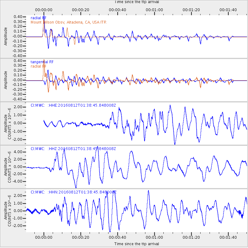
Signal To Noise
| Channel | StoN | STA | LTA |
| CI:MWC: :HHZ:20160812T01:38:45.848008Z | 3.9380293 | 4.1691473E-7 | 1.0586888E-7 |
| CI:MWC: :HHN:20160812T01:38:45.848008Z | 1.0673041 | 1.9679094E-7 | 1.8438132E-7 |
| CI:MWC: :HHE:20160812T01:38:45.848008Z | 0.93512034 | 1.7797174E-7 | 1.9031961E-7 |
| Arrivals |
| Ps | 3.8 SECOND |
| PpPs | 10 SECOND |
| PsPs/PpSs | 14 SECOND |


