You are here: Home > Network List > GS - US Geological Survey Networks Stations List
> Station DEC09 Decatur Surface Seismic Site, Decatur, IL, USA > Earthquake Result Viewer
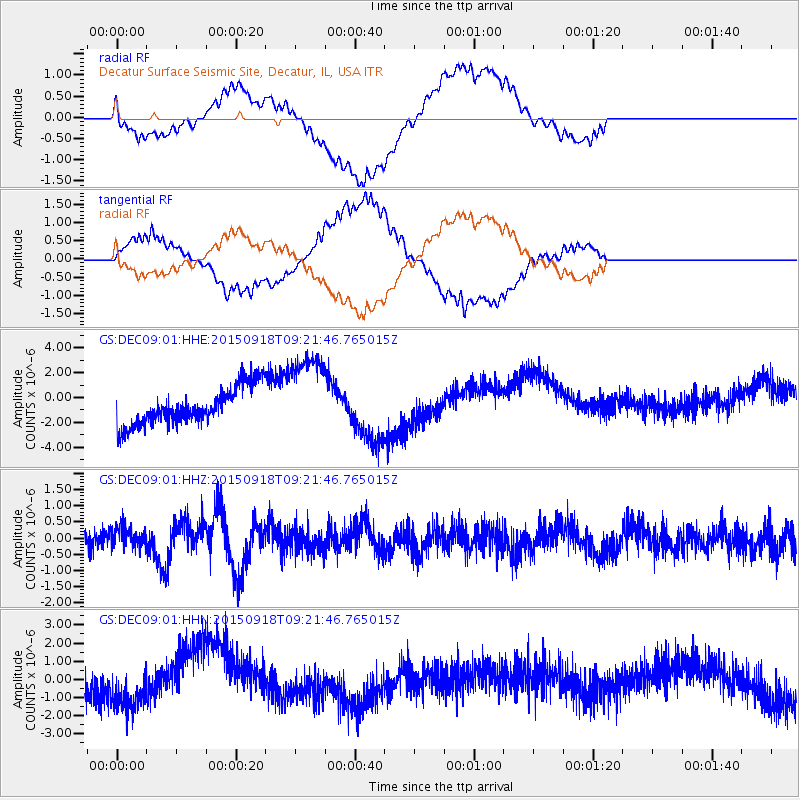
DEC09 Decatur Surface Seismic Site, Decatur, IL, USA - Earthquake Result Viewer
*The percent match for this event was below the threshold and hence no stack was calculated.
| Earthquake location: |
Off Coast Of Central Chile |
| Earthquake latitude/longitude: |
-32.4/-72.2 |
| Earthquake time(UTC): |
2015/09/18 (261) 09:10:44 GMT |
| Earthquake Depth: |
8.7 km |
| Earthquake Magnitude: |
6.3 MWP |
| Earthquake Catalog/Contributor: |
NEIC PDE/NEIC COMCAT |
|
| Network: |
GS US Geological Survey Networks |
| Station: |
DEC09 Decatur Surface Seismic Site, Decatur, IL, USA |
| Lat/Lon: |
39.87 N/88.92 W |
| Elevation: |
207 m |
|
| Distance: |
73.6 deg |
| Az: |
346.678 deg |
| Baz: |
165.329 deg |
| Ray Param: |
$rayparam |
*The percent match for this event was below the threshold and hence was not used in the summary stack. |
|
| Radial Match: |
49.446636 % |
| Radial Bump: |
400 |
| Transverse Match: |
47.98563 % |
| Transverse Bump: |
400 |
| SOD ConfigId: |
1156111 |
| Insert Time: |
2015-10-02 09:26:02.506 +0000 |
| GWidth: |
2.5 |
| Max Bumps: |
400 |
| Tol: |
0.001 |
|
Signal To Noise
| Channel | StoN | STA | LTA |
| GS:DEC09:01:HHZ:20150918T09:21:46.765015Z | 1.2316911 | 3.276495E-7 | 2.6601595E-7 |
| GS:DEC09:01:HHN:20150918T09:21:46.765015Z | 1.4993793 | 1.2111217E-6 | 8.077487E-7 |
| GS:DEC09:01:HHE:20150918T09:21:46.765015Z | 2.246065 | 3.4684335E-6 | 1.5442268E-6 |
| Arrivals |
| Ps | |
| PpPs | |
| PsPs/PpSs | |


