OXF Oxford, Mississippi, USA - Earthquake Result Viewer
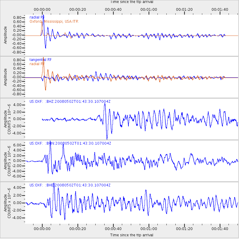
Earthquake location: Andreanof Islands, Aleutian Is.
Earthquake latitude/longitude: 51.9/-177.5
Earthquake time(UTC): 2008/05/02 (123) 01:33:37 GMT
Earthquake Depth: 14 km
Earthquake Magnitude: 6.3 MB, 6.8 MS, 6.6 MW, 6.6 MW
Earthquake Catalog/Contributor: WHDF/NEIC
Network: US United States National Seismic Network
Station: OXF Oxford, Mississippi, USA
Lat/Lon: 34.51 N/89.41 W
Elevation: 101 m
Distance: 62.7 deg
Az: 68.299 deg
Baz: 315.757 deg
Ray Param: 0.06007237
Estimated Moho Depth: 10.0 km
Estimated Crust Vp/Vs: 1.60
Assumed Crust Vp: 6.38 km/s
Estimated Crust Vs: 3.988 km/s
Estimated Crust Poisson's Ratio: 0.18
Radial Match: 96.19007 %
Radial Bump: 348
Transverse Match: 89.0078 %
Transverse Bump: 400
SOD ConfigId: 2504
Insert Time: 2010-03-05 06:01:39.525 +0000
GWidth: 2.5
Max Bumps: 400
Tol: 0.001

Signal To Noise

ChannelStoNSTALTA
US:OXF: :BHN:20080502T01:43:30.107004Z30.5302522.7998717E-69.170812E-8
US:OXF: :BHE:20080502T01:43:30.107004Z4.006417.2358023E-71.8060562E-7
US:OXF: :BHZ:20080502T01:43:30.107004Z4.5969638.365891E-71.8198735E-7
Arrivals
Ps1.0 SECOND
PpPs3.9 SECOND
PsPs/PpSs4.9 SECOND