You are here: Home > Network List > US - United States National Seismic Network Stations List
> Station OXF Oxford, Mississippi, USA > Earthquake Result Viewer
OXF Oxford, Mississippi, USA - Earthquake Result Viewer

| Earthquake location: |
Kuril Islands |
| Earthquake latitude/longitude: |
51.0/157.6 |
| Earthquake time(UTC): |
2008/07/24 (206) 01:43:16 GMT |
| Earthquake Depth: |
27 km |
| Earthquake Magnitude: |
6.0 MB, 6.0 MS, 6.2 MW, 6.2 MW |
| Earthquake Catalog/Contributor: |
WHDF/NEIC |
|
| Network: |
US United States National Seismic Network |
| Station: |
OXF Oxford, Mississippi, USA |
| Lat/Lon: |
34.51 N/89.41 W |
| Elevation: |
101 m |
|
| Distance: |
76.5 deg |
| Az: |
51.405 deg |
| Baz: |
323.239 deg |
| Ray Param: |
0.05089534 |
| Estimated Moho Depth: |
10.25 km |
| Estimated Crust Vp/Vs: |
1.60 |
| Assumed Crust Vp: |
6.38 km/s |
| Estimated Crust Vs: |
3.988 km/s |
| Estimated Crust Poisson's Ratio: |
0.18 |
|
| Radial Match: |
91.1453 % |
| Radial Bump: |
400 |
| Transverse Match: |
84.78677 % |
| Transverse Bump: |
400 |
| SOD ConfigId: |
2504 |
| Insert Time: |
2010-03-05 06:01:49.491 +0000 |
| GWidth: |
2.5 |
| Max Bumps: |
400 |
| Tol: |
0.001 |
|
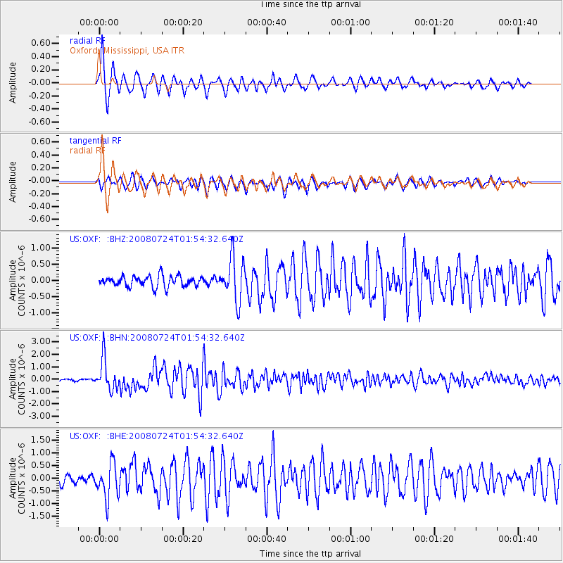
Signal To Noise
| Channel | StoN | STA | LTA |
| US:OXF: :BHN:20080724T01:54:32.640Z | 15.560516 | 1.2876599E-6 | 8.275175E-8 |
| US:OXF: :BHE:20080724T01:54:32.640Z | 3.6722288 | 7.079886E-7 | 1.9279533E-7 |
| US:OXF: :BHZ:20080724T01:54:32.640Z | 4.128195 | 6.8408553E-7 | 1.6571057E-7 |
| Arrivals |
| Ps | 1.0 SECOND |
| PpPs | 4.0 SECOND |
| PsPs/PpSs | 5.0 SECOND |


