OXF Oxford, Mississippi, USA - Earthquake Result Viewer
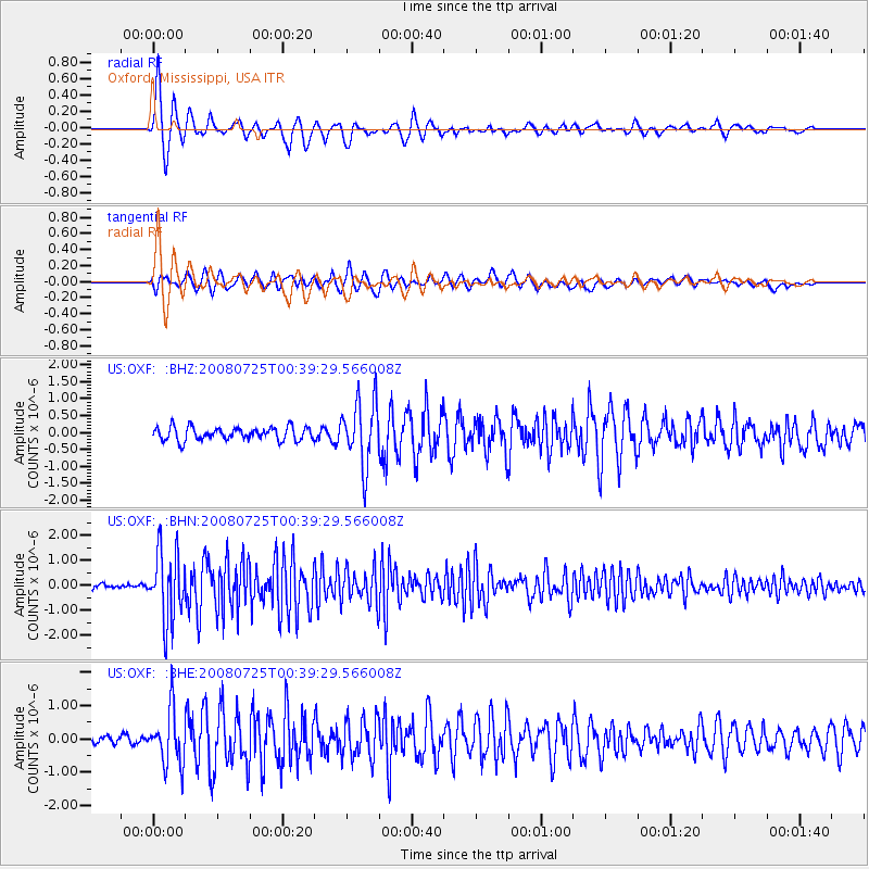
Earthquake location: Rat Islands, Aleutian Islands
Earthquake latitude/longitude: 51.3/179.0
Earthquake time(UTC): 2008/07/25 (207) 00:29:22 GMT
Earthquake Depth: 21 km
Earthquake Magnitude: 5.7 MB, 5.5 MS, 5.9 MW, 5.9 MW
Earthquake Catalog/Contributor: WHDF/NEIC
Network: US United States National Seismic Network
Station: OXF Oxford, Mississippi, USA
Lat/Lon: 34.51 N/89.41 W
Elevation: 101 m
Distance: 64.9 deg
Az: 65.725 deg
Baz: 316.104 deg
Ray Param: 0.058605753
Estimated Moho Depth: 10.0 km
Estimated Crust Vp/Vs: 1.60
Assumed Crust Vp: 6.38 km/s
Estimated Crust Vs: 3.988 km/s
Estimated Crust Poisson's Ratio: 0.18
Radial Match: 93.07992 %
Radial Bump: 400
Transverse Match: 90.44473 %
Transverse Bump: 400
SOD ConfigId: 2504
Insert Time: 2010-03-05 06:01:51.045 +0000
GWidth: 2.5
Max Bumps: 400
Tol: 0.001

Signal To Noise

ChannelStoNSTALTA
US:OXF: :BHN:20080725T00:39:29.566008Z19.6726861.3790361E-67.009903E-8
US:OXF: :BHE:20080725T00:39:29.566008Z4.1550917.9987393E-71.9250456E-7
US:OXF: :BHZ:20080725T00:39:29.566008Z4.90751659.515758E-71.9390171E-7
Arrivals
Ps1.0 SECOND
PpPs3.9 SECOND
PsPs/PpSs4.9 SECOND